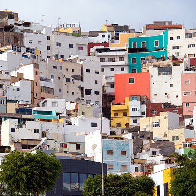
Photo Gallery » Gran Canaria - Landscapes
Pictures of landscapes and views of Gran Canaria. Amazing mountains, cliffs, valleys, coasts. It is paradise for landscape photographers. For more information on this beautiful Canary Island visit: Gran Canaria tourist attractions and sightseeing.


Mountains - best places for Gran Canaria
The best place in Gran Canaria is mountains in my opinion. Amazing nature, stunning landscapes and spectacular trails. View from the neighborhood of Presa y Roque Elba.
Picture number (ID): 1088 Google Map
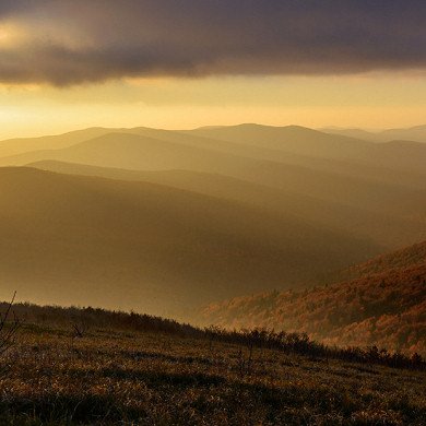
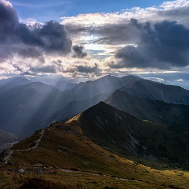
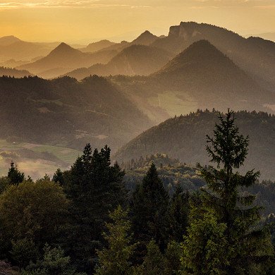
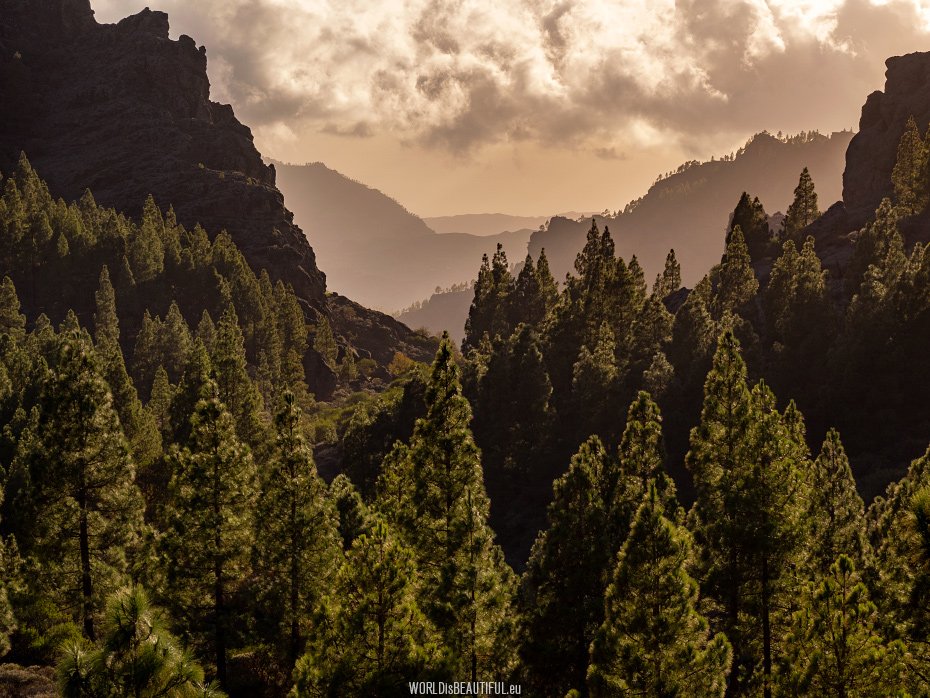
Mountain landscapes in the Canaries
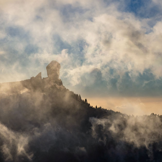
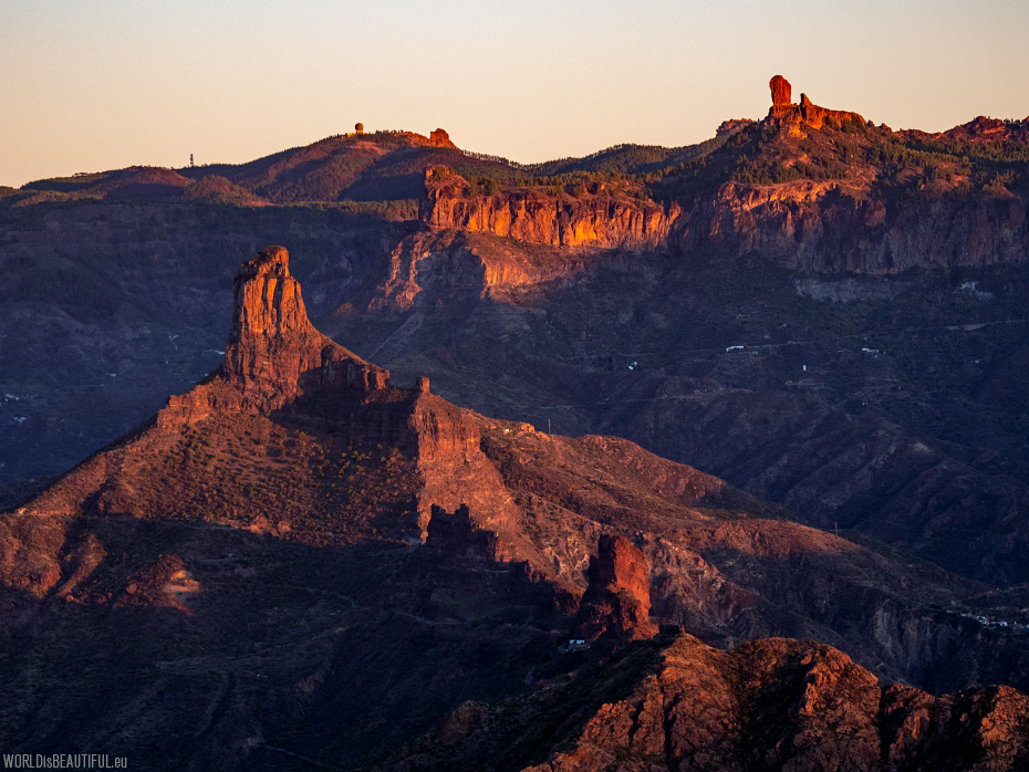
A cool December evening with a picturesque view of one of the most famous rocks in Gran Canaria - Roque Bentayga. There is a wide Altavista massif under this impressive cloud. You can see photos of this large mountain and a description of the trail in the gallery: Best trekking in Gran Canaria.
Picture number (ID): 2378 Google Map
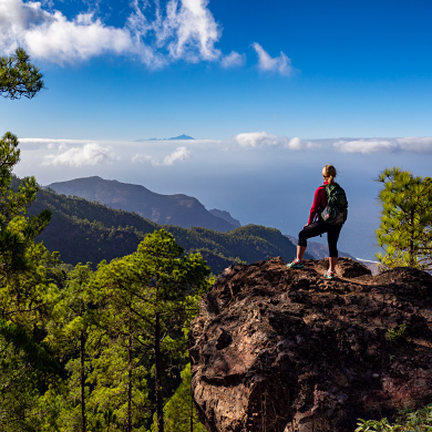
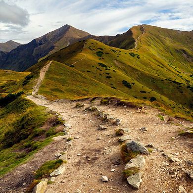
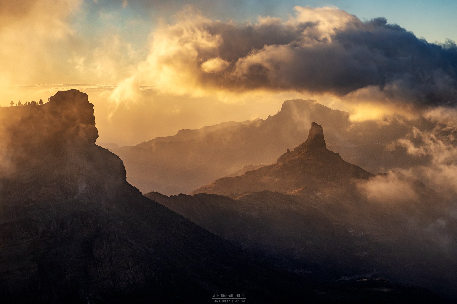
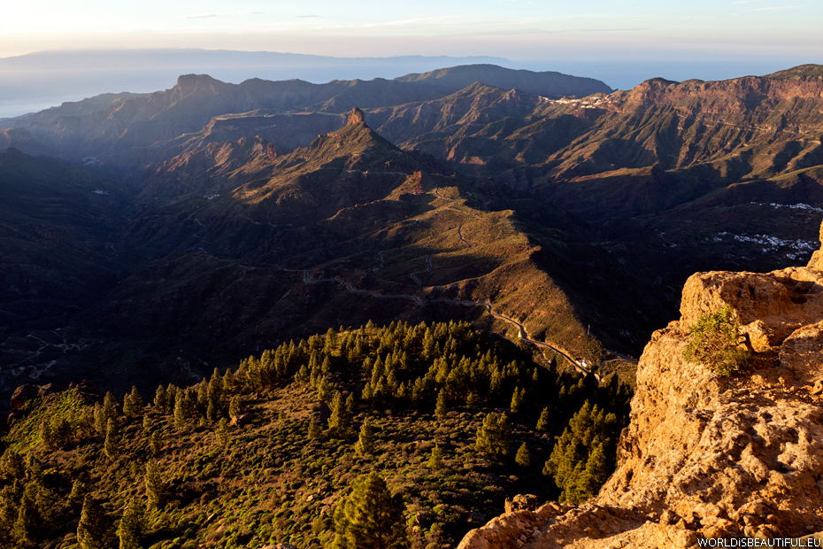
If you are in Gran Canaria, it is worth leaving the hotel and going to the mountains. Winding and steep roads do not encourage you to do it, but for such views it is worth spending an hour behind the wheel. Photo taken from the area of the highest peak of the island: Pico de Las Nieves on Roque Nublo, Altavista and in the distance above the clouds the highest peak in Tenerife - Pico del Teide.
Picture number (ID): 2384 Google Map
Roque Nublo and ravine Barranco de Tejeda
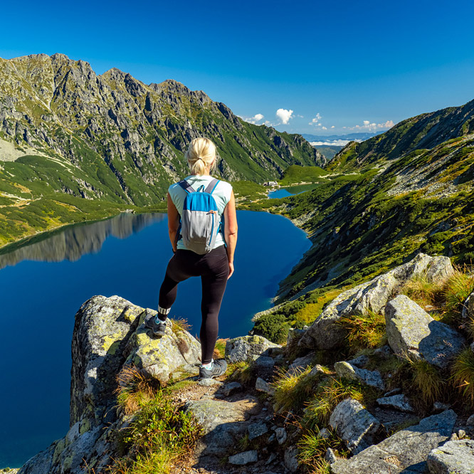
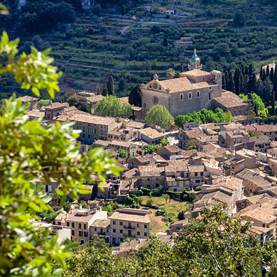
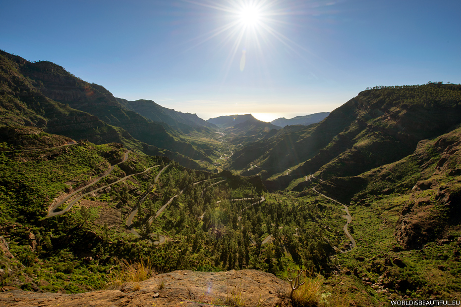
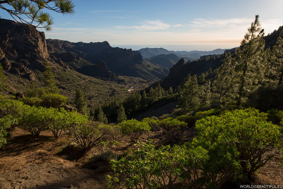
Gran Cananria is one of the great mountain range whose slopes are cut by hundreds of deep valleys and gorges. Landscapes are amazing. You can also see the tiny villages clinging to the slopes of the mountains. See spherical photo from these areas.
Picture number (ID): 290 Google Map Photo Sphere
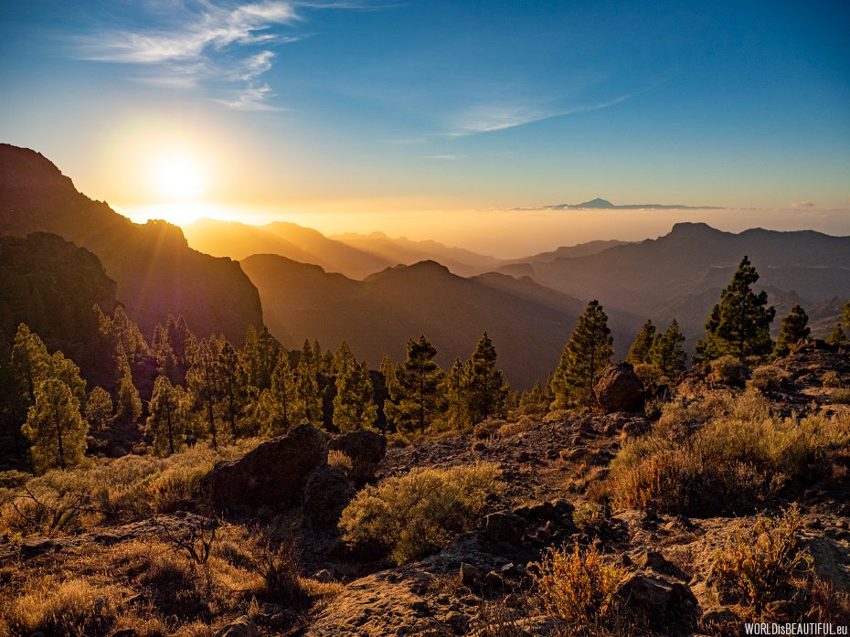
A picturesque sunset in the mountains of Gran Canaria. The clouds were low above the ocean between Gran Canaria and Tenerife. There you can see the Teide volcano - the highest peak in Tenerife above the clouds. Photo from the trail from Cruz Grande to Roque Nublo.
Picture number (ID): 1087 Google Map

The best option to explore Gran Canaria is a a tour by car. We rented a Fiat Panda in Maspalomas. Small car on Grand Canaria is a very good idea. There is so narrowly on many mountain roads, the two cars will not fit on the road.
Picture number (ID): 288 Google Map
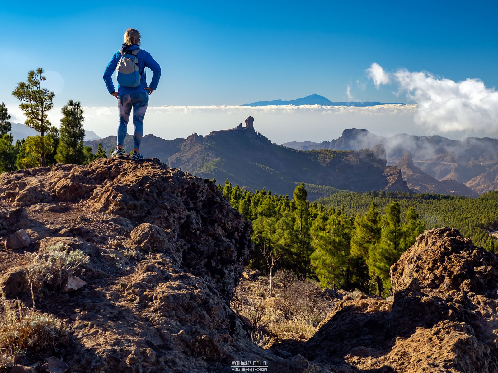
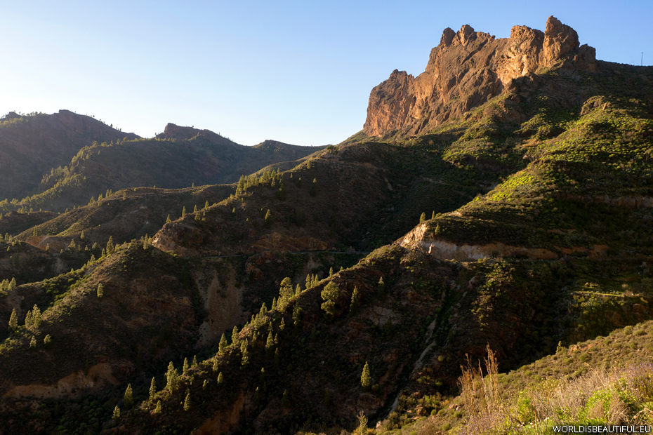
The highest peaks of Gran Canaria
The highest peaks of Gran Canaria: Roque Nublo (1813 m) on the right and Pico de Las Nieves (1949 m) in the distance.
Picture number (ID): 1084
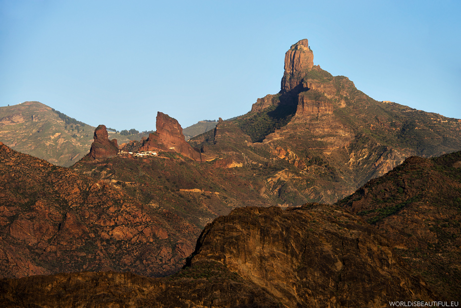
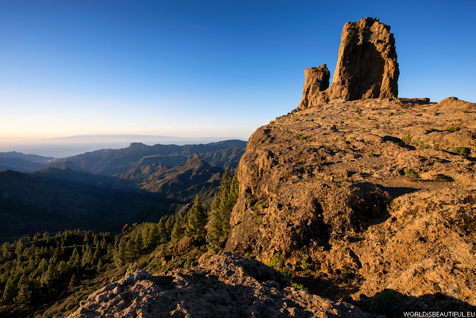
View of the mountains and valley at sunset from the Roque Nublo - the most famous rocks in Gran Canaria. You can see another famous rock - the Roque Bentayga.
Picture number (ID): 294 Google Map
The famous monolithic basalt rock on the hill Bentayga - holy rock for Guanche indigenous people of Gran Canaria.
Picture number (ID): 292 Google Map
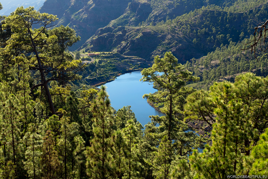
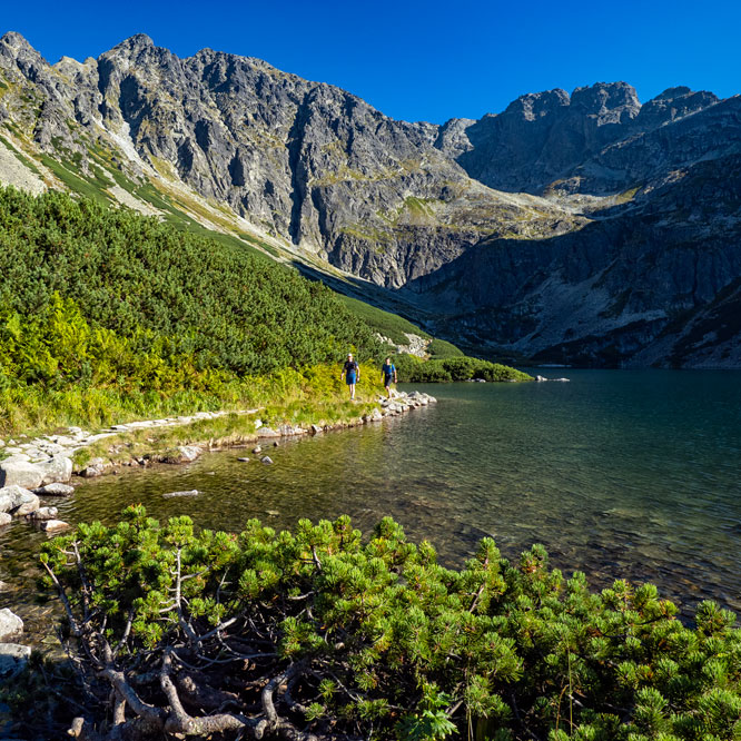
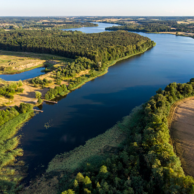
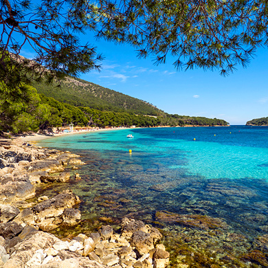
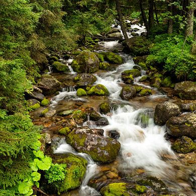
Mountain lake on Gran Canaria, surrounded by a beautiful pine forest.
Picture number (ID): 286 Google Map
Amazing landscapes, monumental rocks, steep slopes and villages on the edges. People build houses on narrow rock shelves and drive cars on the narrow winding roads ...
Picture number (ID): 289 Google Map
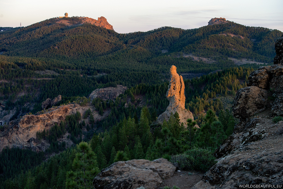
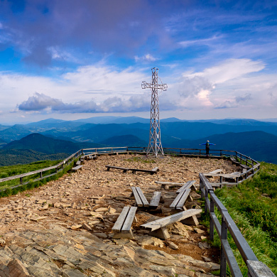
On the right of the radar (ball) you can see the highest mountain in Gran Canaria - Pico de las Nieves (Snow Mountain) 1949m asl. You can get there by car to the top and enjoy the views.
Picture number (ID): 291 Google Map
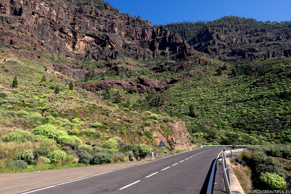
There are all kinds of roads on Gran Canaria: multi-lane highway with long tunnels, good quality local roads and side roads - often winding and narrow for one car, in many places on the shelves of rock and without any barriers ... 30 km you drive an hour or longer...
Picture number (ID): 287 Google Map
Viewpoint Mirador Degollada de Las Yeguas by the road no GC-60 from Maspalomas to Roque Nublo. Our first meeting with landscapes of Gran Canaria.
Picture number (ID): 293 Google Map
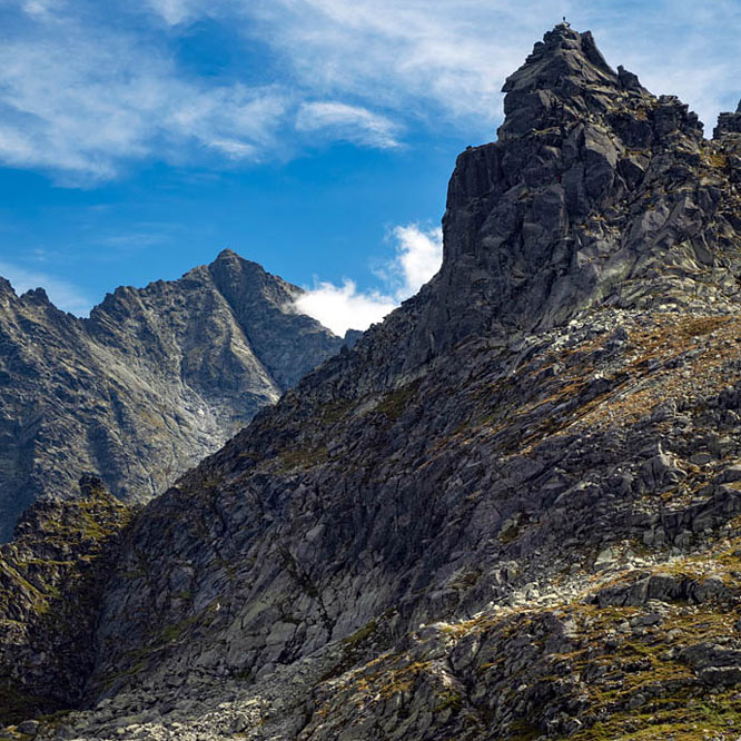
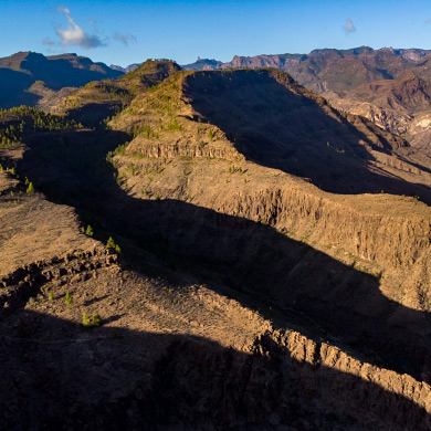
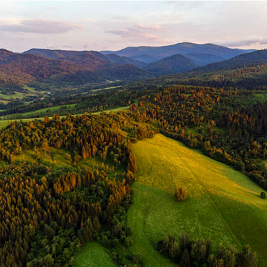
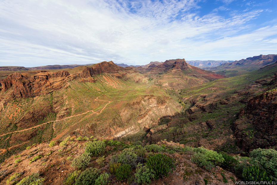
Gran Canaria impresses landscapes and nature - high mountains, uplifted rocks, steep slopes, deep gorges and valleys. Every turn shows another beautiful view. When you drive a car through the mountains you have to stop every few kilometers to enjoy another beautiful view.
Picture number (ID): 285 Google Map
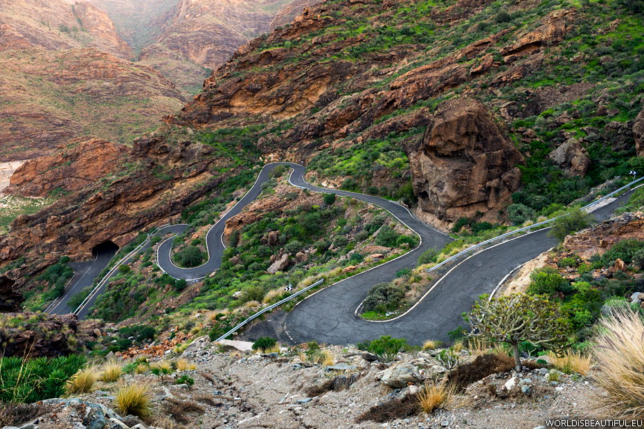
Discovering Gran Canaria by car I recommend to choose the side roads. The roads are very winding and extremely steep uphill. In many places you need to go in first gear with the hope that nothing appears from the opposite direction. But you have to to see them - the landscapes are magnificent.
Picture number (ID): 284 Google Map
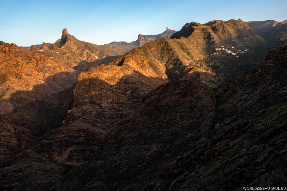
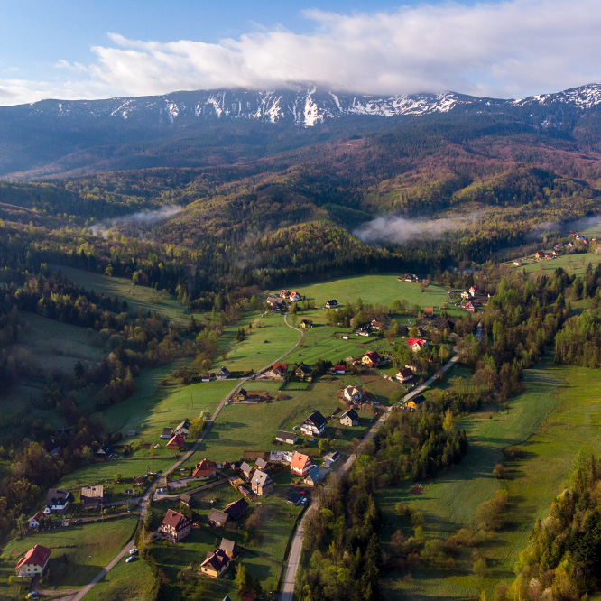
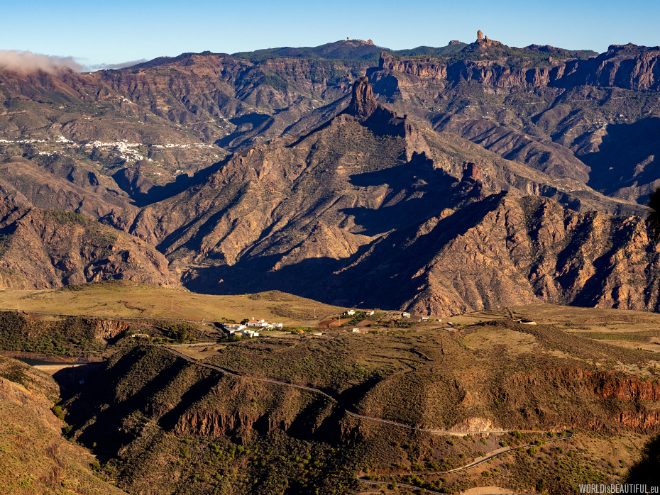
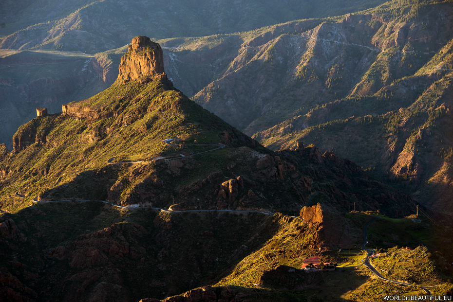
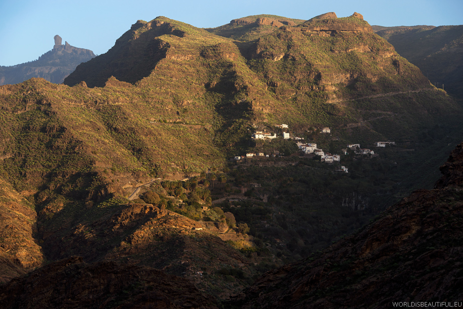
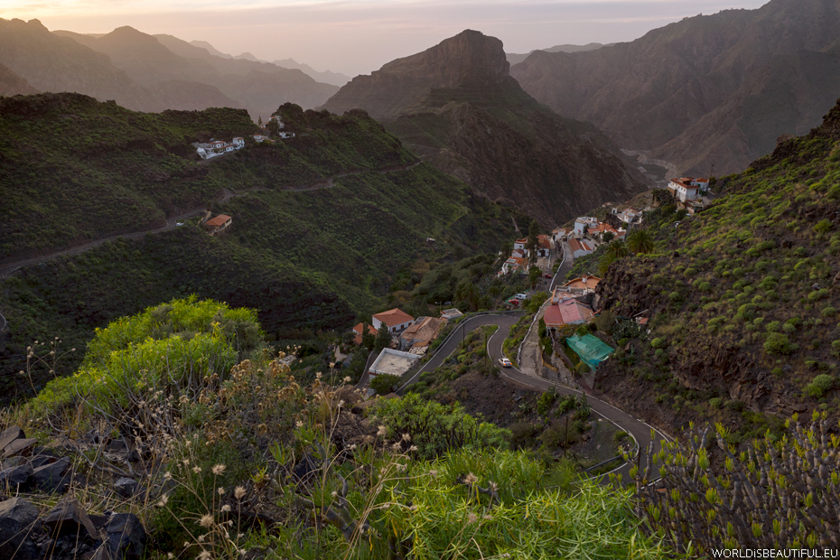
Huge mountains, rocks and valleys ... and cottages on the slopes ... strange that someone built a house so high and live there. There you can see beautifully situated village of Carrizal de Tejeda right on the mountainside. The two sacred rocks Roque Bentayga and Roque Nublo are at the top of the photo.
Picture number (ID): 283 Google Map
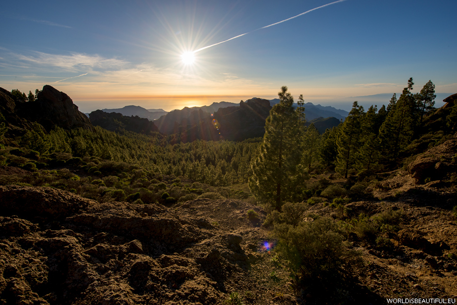
The setting sun, the ocean on the horizon, rocks and pine forest. Trail to Roque Nublo is really beautiful - it is worth to go to this sacred rock at sunset.
Picture number (ID): 282 Google Map
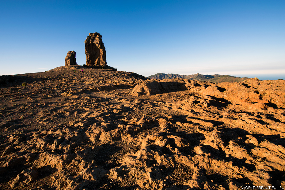
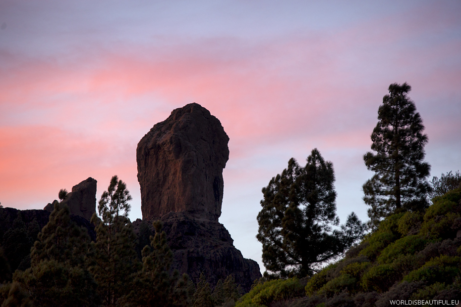
Roque Nublo 1813m asl It is the second highest peak in Gran Canaria. There is a 80 m high basalt monolith at the end of the plateau. Roque Nublo was a place of cult for aborigines.
Picture number (ID): 281 Google Map
In January, the evening was cool here - about 9° C and a fairly strong wind. The temperature at the top is about 10 degrees lower than on the beach in Maspalomas. The trail from the parking lot is not long but it is worth to wear pants, fleece and even a jacket.
Picture number (ID): 279 Google Map
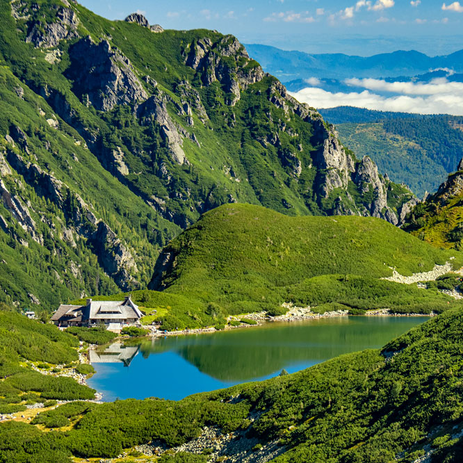
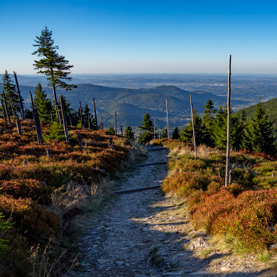
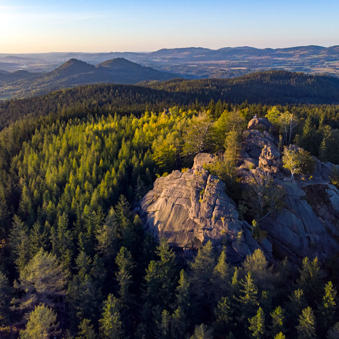
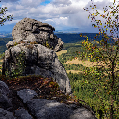
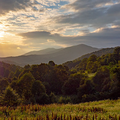
Scenery with Gran Canaria impressed me very much. I will have to go back there one day to discover this island to go trekking. There are about 800 km of trails for hiking on the island.
Picture number (ID): 278 Google Map
Evening at Gran Canaria - the setting sun illuminates the side of the mountain and in the background you can see a sacred rock - symbol of the island - Roque Nublo.
Picture number (ID): 277 Google Map
Nature such a great and beautiful ... a man small and inconspicuous ... Most important is to live in harmony with nature and not take it too much ...
Picture number (ID): 276 Google Map Photo Sphere
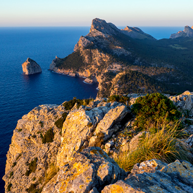
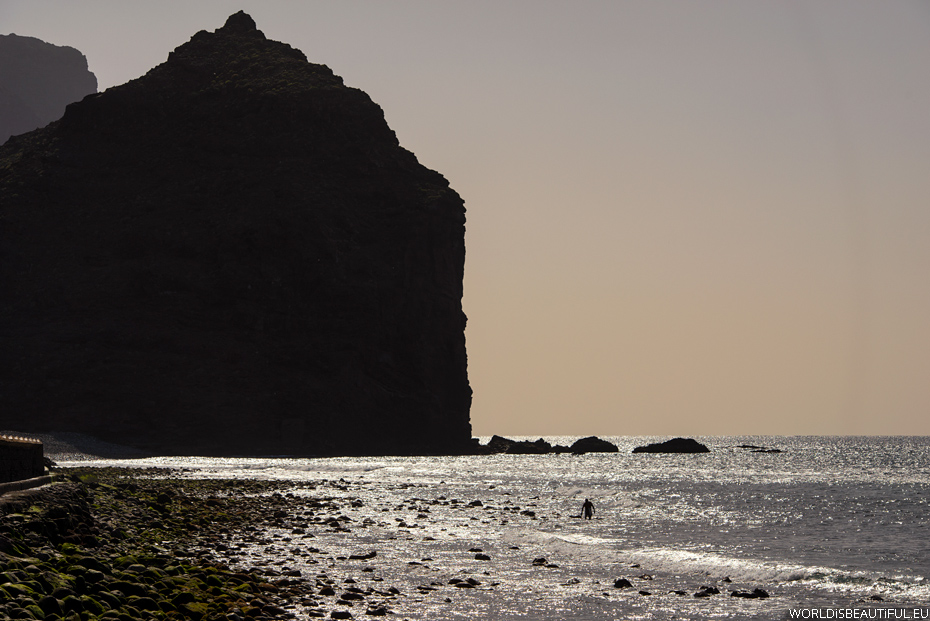
A viewpoint is located on the western extreme point of the island of Gran Canaria at a closed road (GC-200). The point is the balcony suspended over a vertical cliff falling into the Atlantic, and the rocks look like the tail of a dragon. A viewpoint is the end of the road - barrier across the road makes it impossible to continue the trip.
Picture number (ID): 275 Google Map
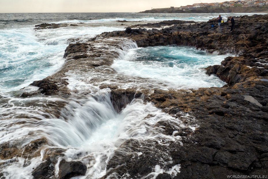
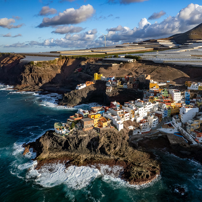
Rocky, the east coast of Gran Canaria with spectacular wells in the lava - El Bufadero. Find the exit 8 off the highway and take a moment and see an interesting place.
Picture number (ID): 295 Google Map
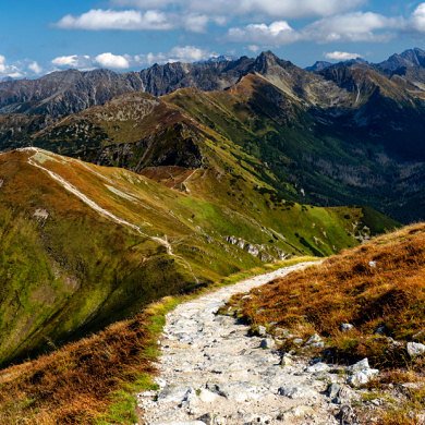
The road through the mountains
Road No. GC-200 from Mogán to La Aldea de San Nicolas de Tolentino - very good quality and interesting views.
Picture number (ID): 274 Google Map
Mountains, valleys, winding roads cut into the hillside and tiny village ... and every valley is prettier ... It should get off the main roads to see such views ...
Picture number (ID): 273 Google Map
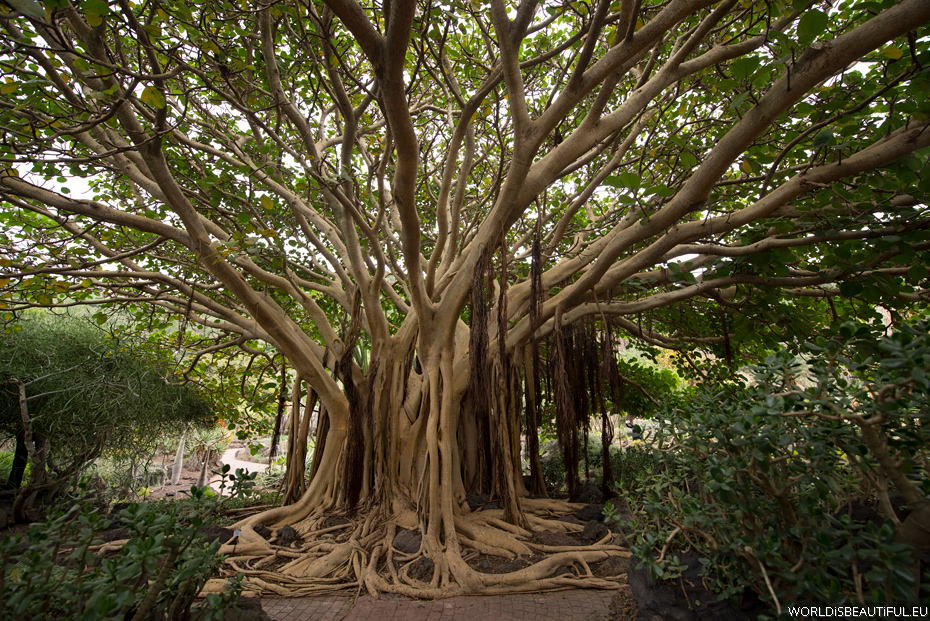
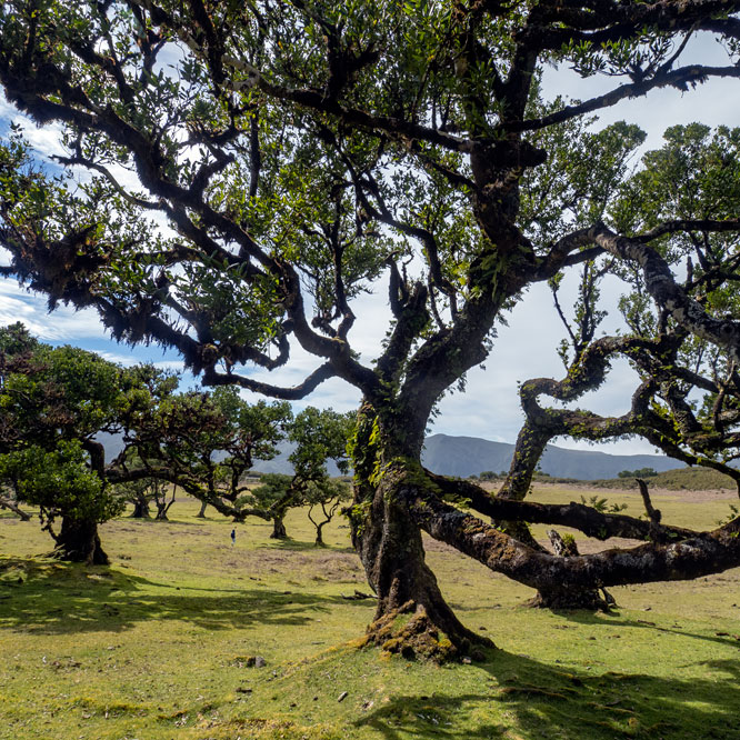
The giant ficus in a botanical garden Jardin Botanico Viera y Clavijo (Jardín Canario). You should go there for a few hours because the garden is very large and interesting. Entrance to the garden is free.
Picture number (ID): 272 Google Map
Botanical Garden, Gran Canaria
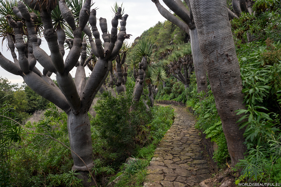
Canary Islands dragon trees - Dracaena draco (drago) in the botanical garden Jardin Botanico Viera y Clavijo (Jardín Canario).
Picture number (ID): 271 Google Map
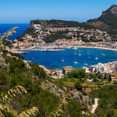
Gran Canaria is a beautiful island - so much breathtaking landscapes here - mountains, valleys, beaches, dunes, forests, lakes ... I had already visited five other Canary Islands ... but for me, Gran Canaria is the most beautiful - I have to come back!
Picture number (ID): 270 Google Map
Find an apartment
We stayed here:
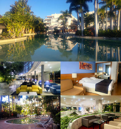
Gran Canaria Spain
The description and photos of the hotel, rooms, swimming pools, gardens and restaurants.
Avenida Tour Operador Tui
35100 Maspalomas, Las Palmas, Spain
January 2017 with TUI.
Two hotels: Maspalomas Princess and Tabaiba Princess with a common garden and swimming pools.
Very good hotel for a 4 ****
Rooms clean and spacious, the food was good, very large swimming pools and beautiful garden.
All pictures were taken by LG 4G phone.
See other galleries: