Photo Gallery » Giewont, Tatra Mountains
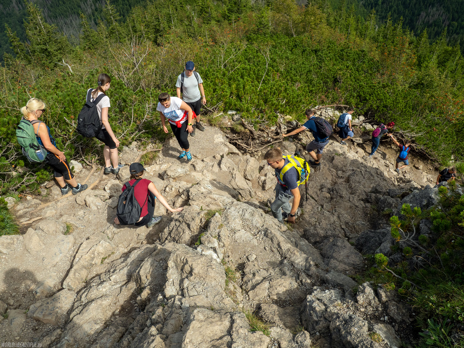
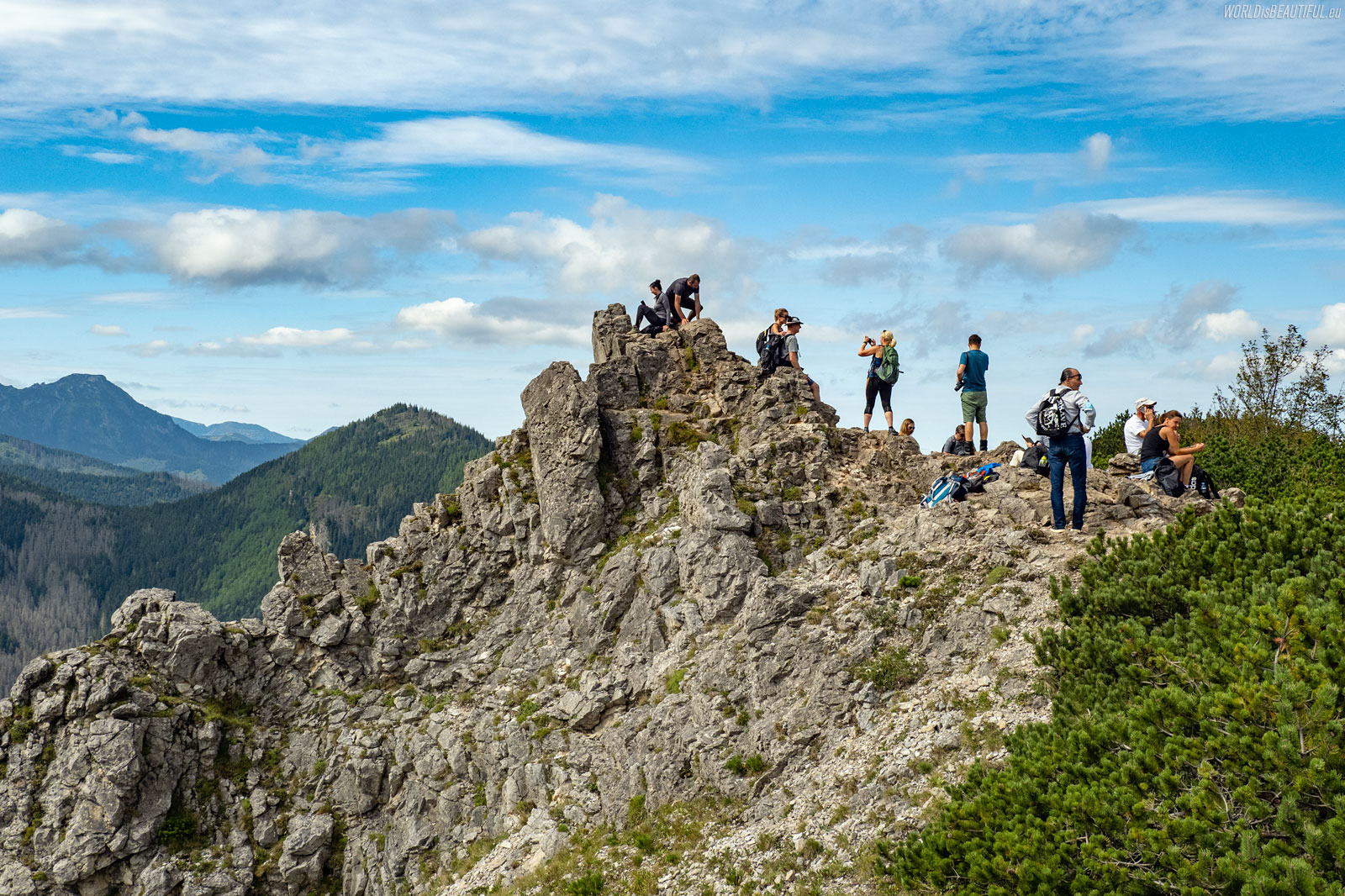
Giewont is the most famous, most frequently climbed and probably the most crowded mountain in the Polish Tatras. You can go to Giewont along several tourist routes that connect at the Wyżnia Kondracka Przełęcz. There is only one one-way route from the pass to the top, with several chains to facilitate climbing over slippery rocks. Giewont is not a difficult mountain but it should not be underestimated and go there with sneakers or without additional clothes and a jacket. Because these are the Tatra Mountains and the weather can change very quickly. I would not recommend climbing Giewont in the rain either - the rocks are very slippery then, and the metal cross on the top can attract lightning.
I did not climb Giewont until the third time - I turned twice from the Wyżnia Przełęcz Kondracka because a storm was approaching. The summit was very close, but you had to withdraw. The mountain will not disappear - it will wait. You will climb on it next time.
I called our trip "Tour de Giewont" because we made quite a nice circle. We left Zakopane in the morning from Rondo Jana Pawła II Rondo and through Dolina Białego, Sarnia Skała, Polana Stążyska, Grzybowiec we went to Giewont, we returned through Kondratowa Dolina and Kuźnice. Trail length: 19 km, walking time: 9 hours, ascents and descents sum: 1,525 meters. To make it easier, here's a link to the map: trail to Giewont.


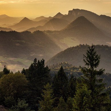
The Giewont massif with the characteristic silhouette of a sleeping knight. The head is Wielki Giewont with a height of 1894 m, the neck is a deep pass called Szczerba (1810 m), and the body is the Dlugi Giewont (1868 m).
Picture number (ID): 1975 Google Map
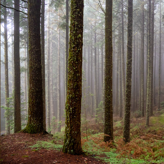
We followed the yellow trail through the Białego Valley from Zakopane. fter about an hour we reached Ścieżka nad Reglami and turned right and along the black trail we reached the Red Pass (Czerwona Przełęcz).
Picture number (ID): 1974 Google Map
We turned right on the pass and after about 10 minutes we climbed Sarnia Skała.
Picture number (ID): 1973 Google Map
A moment of rest, a few photos and admiring the landscapes on Sarnia Skała (Sarnia Rock).
Picture number (ID): 1972 Google Map
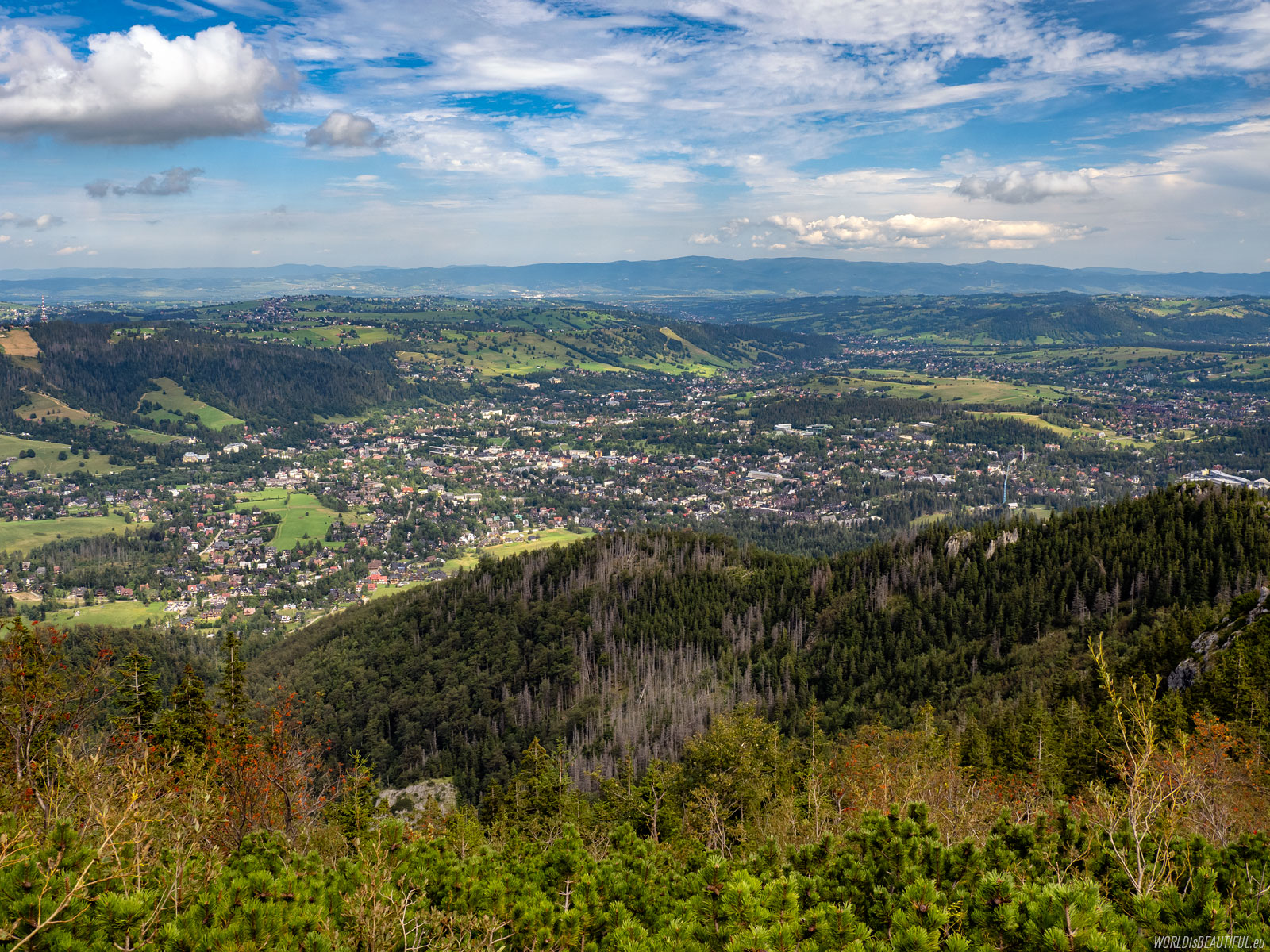
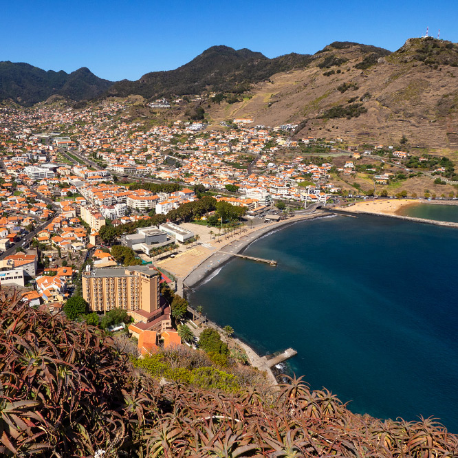
View of Zakopane from Sarnia Skala
Zakopane is beautifully visible above the forest and we only reached 1377 meters in height.
Picture number (ID): 1971 Google Map
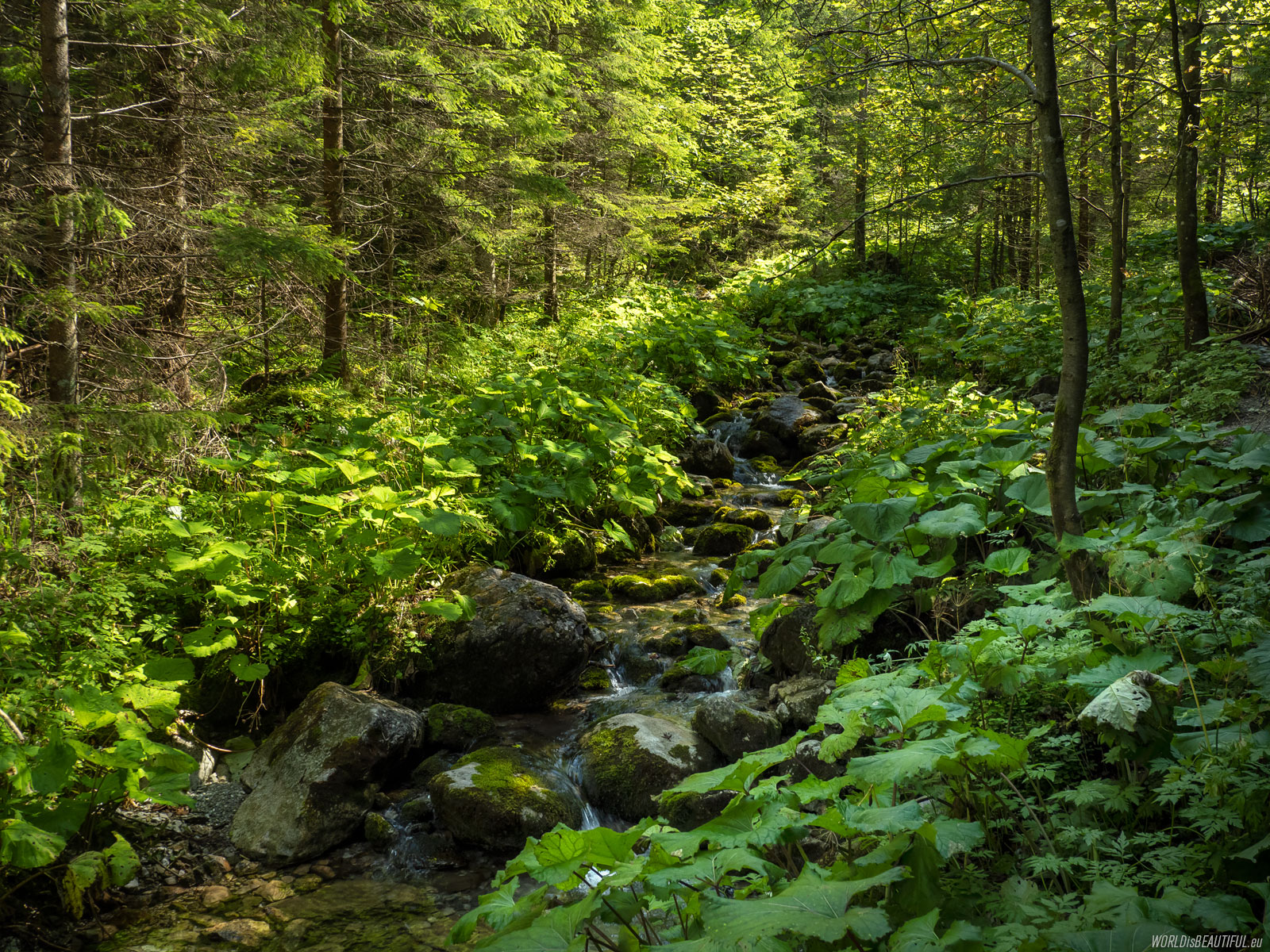
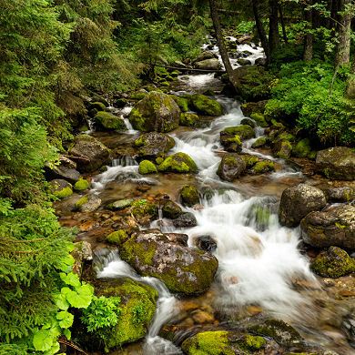
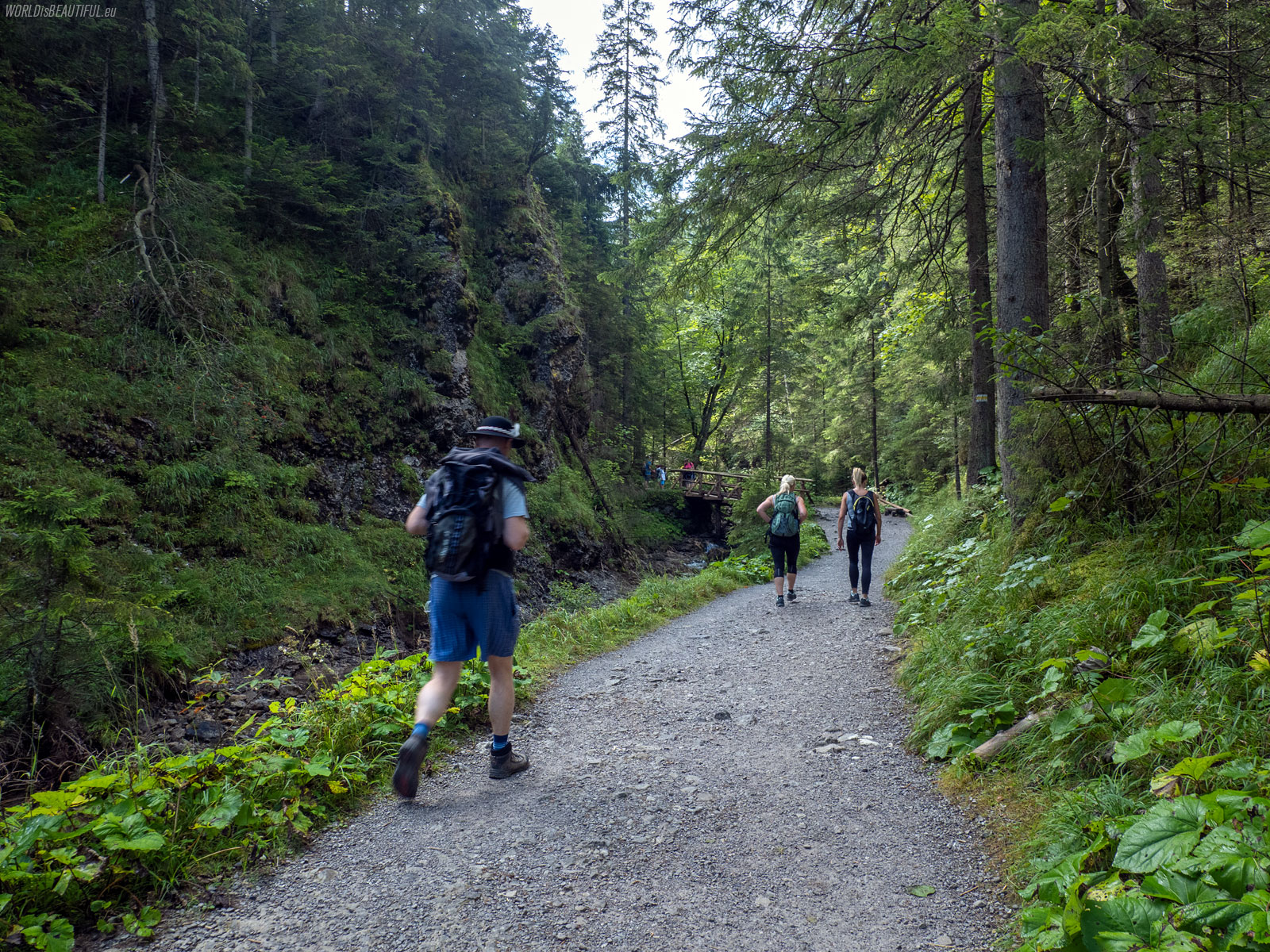
The trail to the Siklawica waterfall
There, you can take a break at the Parzenica Tea House after going down the black trail to Strążyska Polana. It is not a hostel but rather a bar - you can drink and eat local food there. After the break, I recommend a short walk along the yellow trail to the Siklawica waterfall.
Picture number (ID): 1969 Google Map
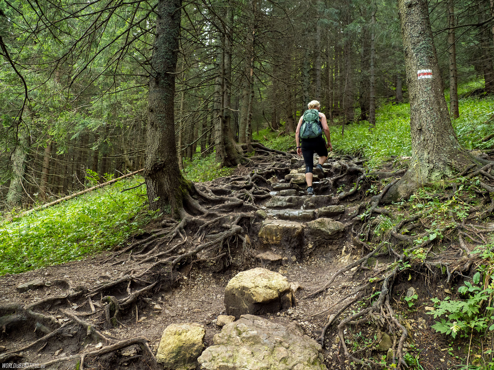
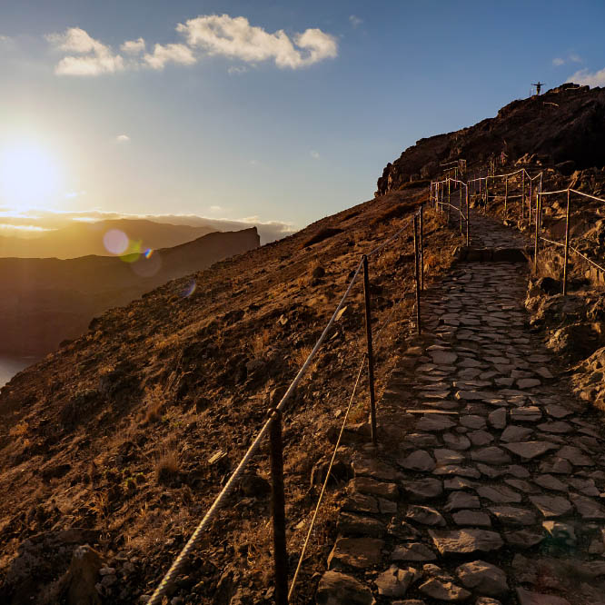
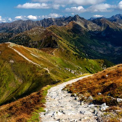
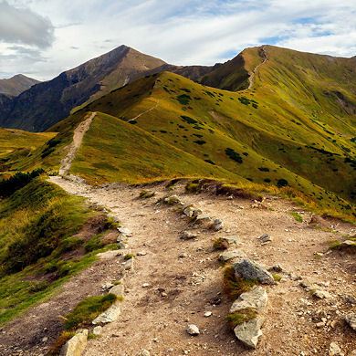
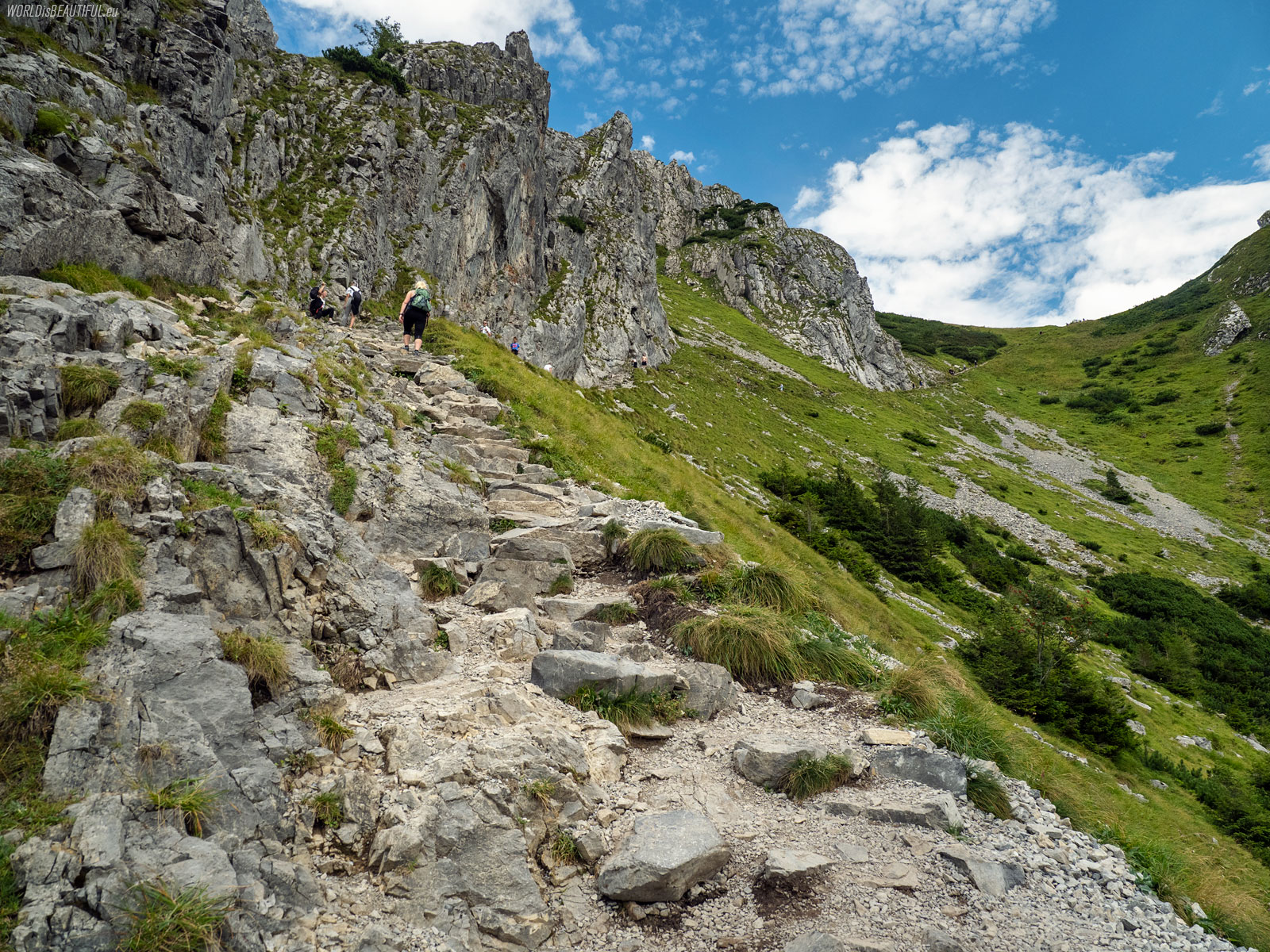
The red hiking trail to Giewont
We followed the red trail to Giewont from Polana Strążyska. According to the map, the walking time to the Wyższa Kondracka Pass is 2 hours and 20 minutes. The sum of the ascents is 765 meters. The trail is in the forest for the first hour.
Picture number (ID): 1968 Google Map
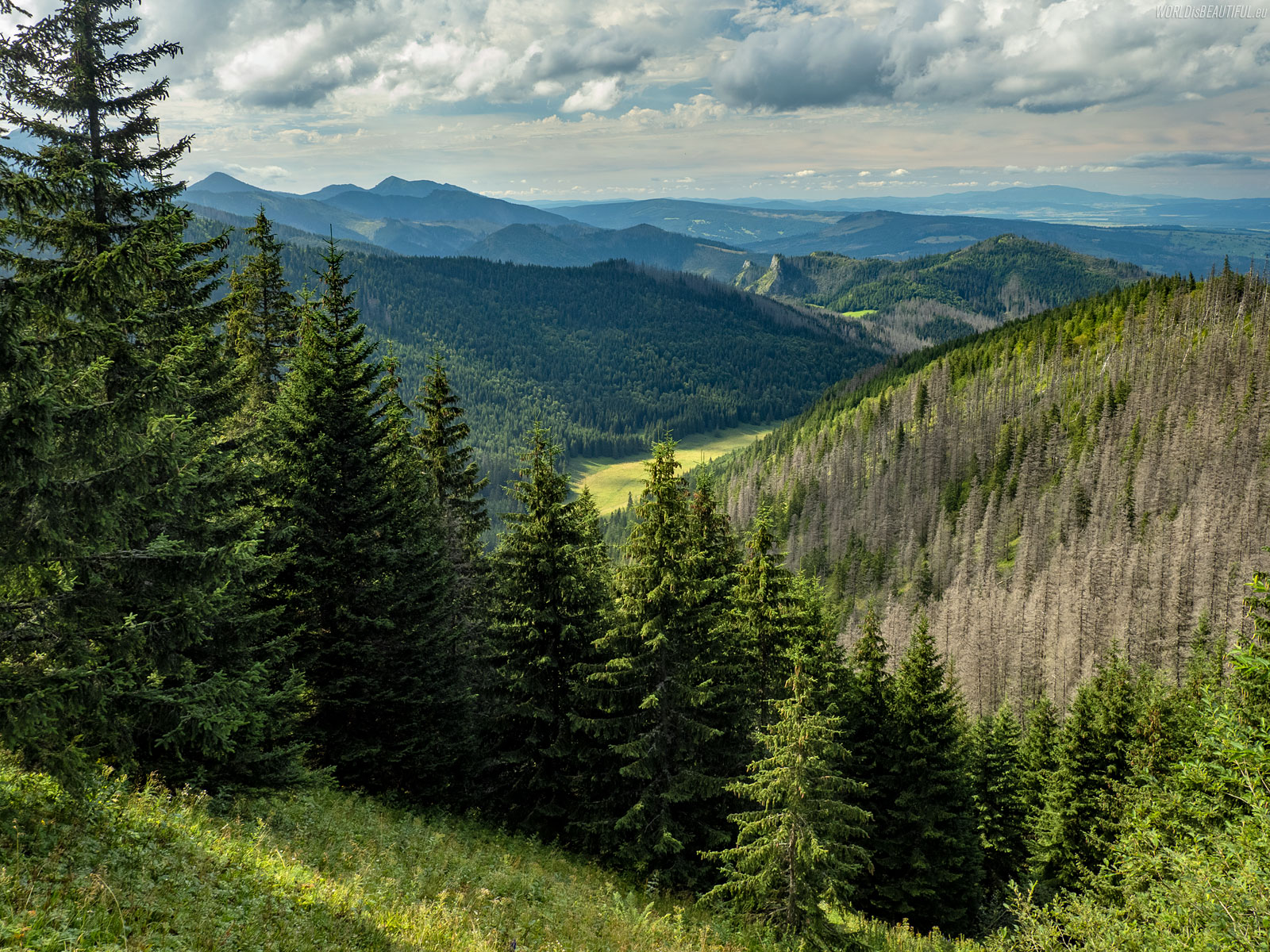
View of the Little Meadow Valley
We keep going up and we can see more and more. Here is the view from the red trail to Wielka Polana in the Little Meadow Valley (Dolina Małej Łąki).
Picture number (ID): 1967 Google Map
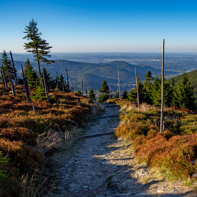
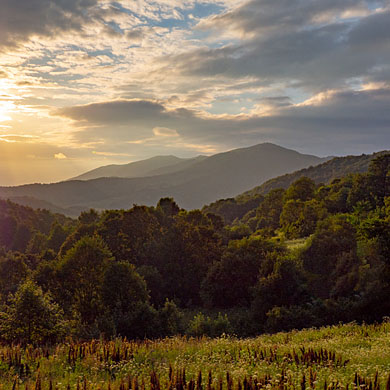
Such landscapes always amaze me: mountains, rocks, grasses, mountain pines ... in such places I feel like in the most beautiful botanical garden. It's hard to resist taking pictures ... but you have to go, because it's still a bit to the top. Getting to the mountain peak is only half way. We still have to go back down before dark.
Picture number (ID): 1966 Google Map
You can enter Giewont from different sides. The easiest and shortest trail to Giewont is the blue trail from Kuźnice through the Kondratowa Valley. I do not recommend this trail because it always has the most people. You can also climb Giewont along the yellow trail through the Mała Łąki Valley and the Kondracka Pass. However, my favorite path is the red trail from the Strążyska Valley through Grzybowiec. In my opinion, this route offers the most beautiful views.
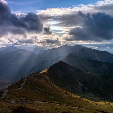
Picture number (ID): 1965 Google Map
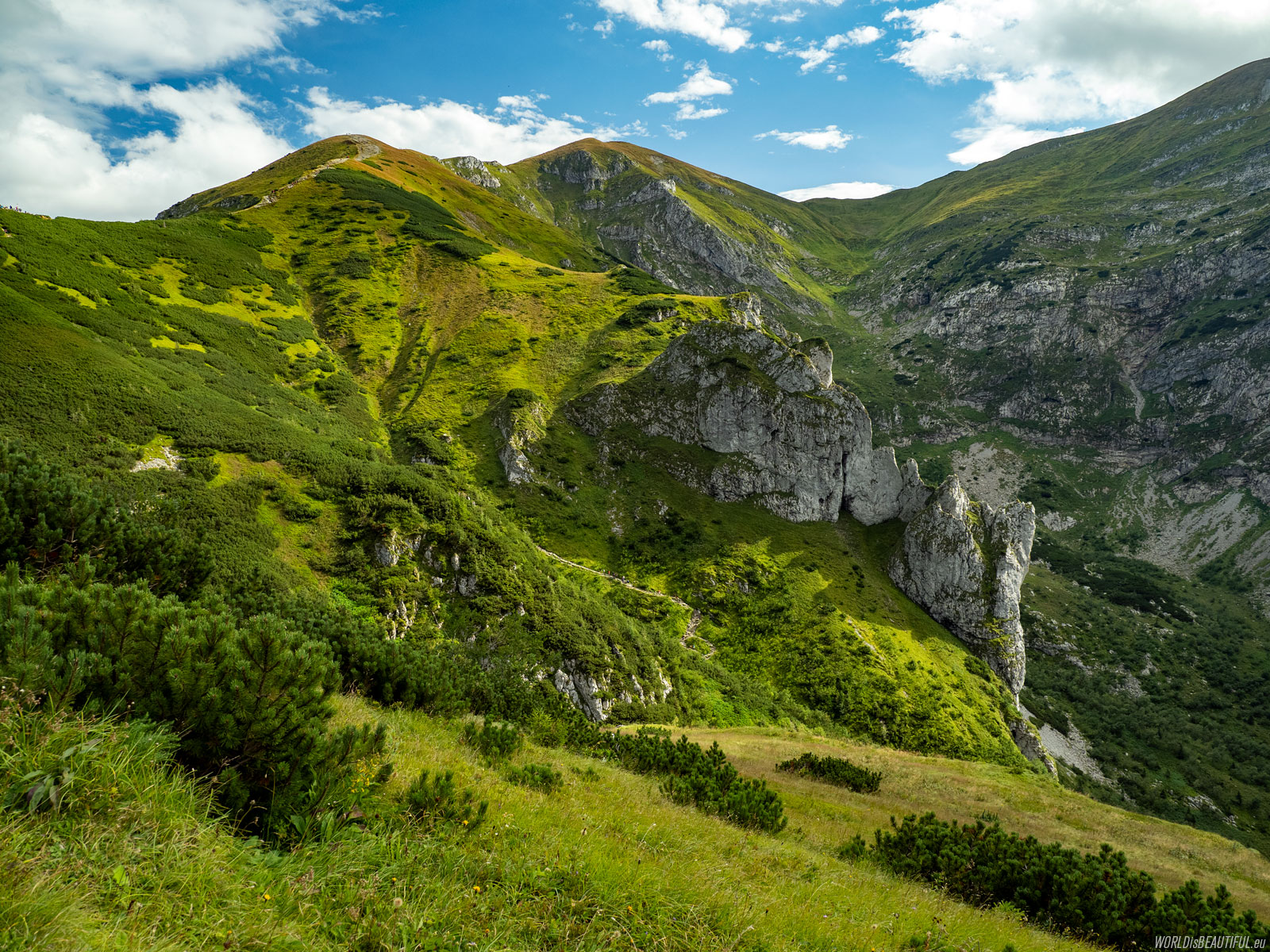
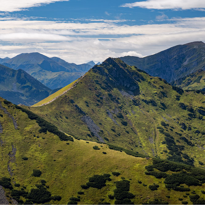
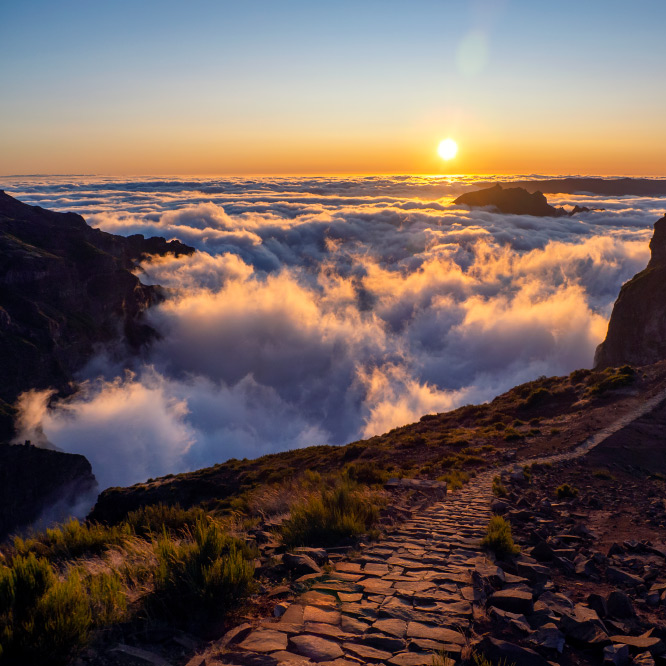
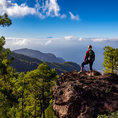
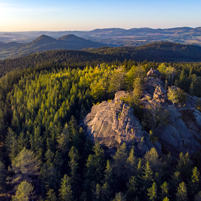
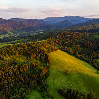
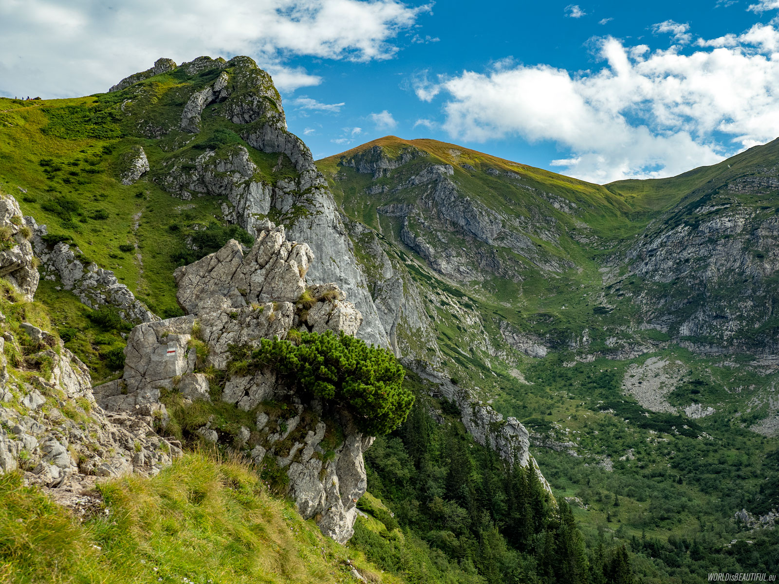
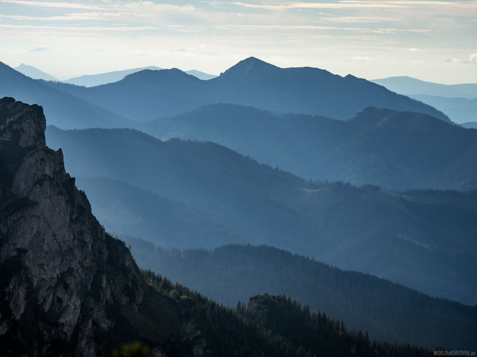
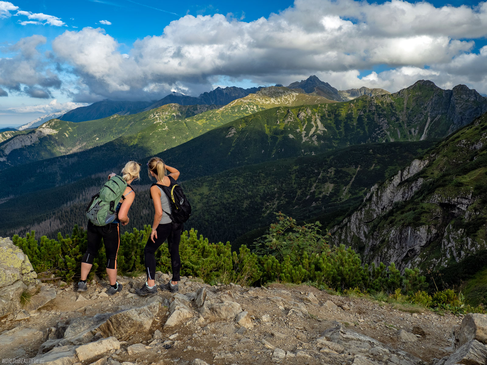
The opportunity to admire such natural wonders is the reward for the effort of walking in the mountains ... The photo shows Kondracka Kopa, it is the easternmost peak of Czerwone Wierchy.
Picture number (ID): 1964 Google Map
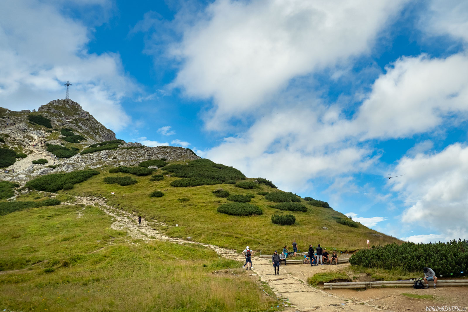
We reached the Wyżnia Kondracka Przełęcz. During the rest, we could see the glider's flight right next to the top of Giewont. The glider came almost silently from Zakopane, made a large arc around the top and flew away ...
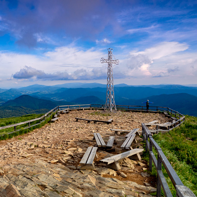
Picture number (ID): 1963 Google Map
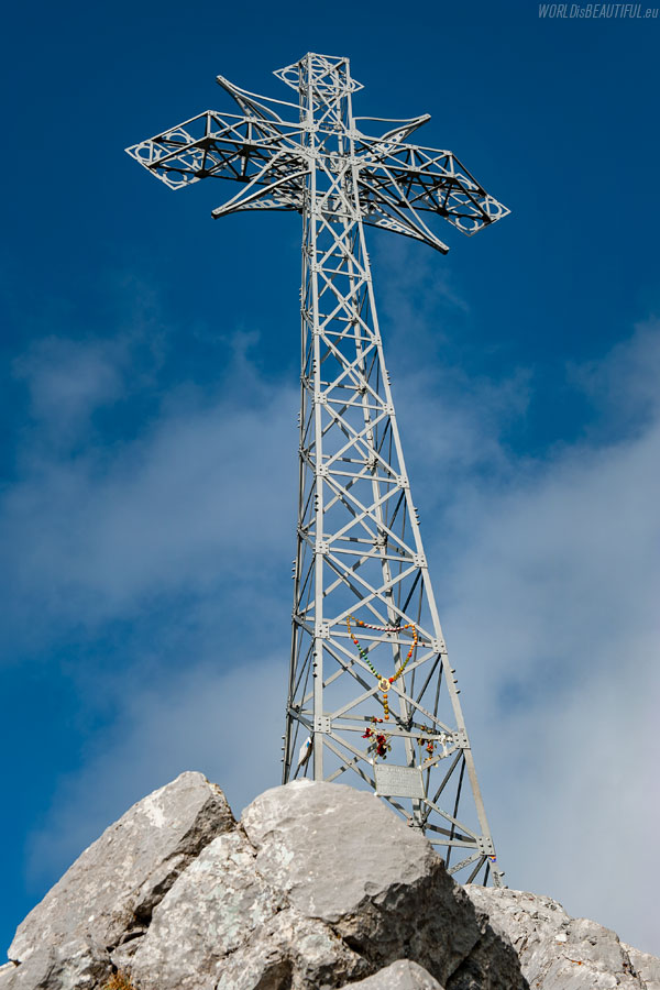
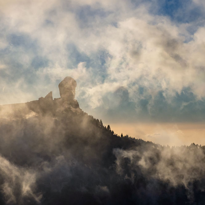
The iron cross on top of Giewont is 15 meters high and weighs 1,819 kilograms. The cross was installed on August 19, 1901 to celebrate the 1900th birthday of Jesus Christ. Thanks to this, the peak of Giewont is extremely dangerous during a storm. Tourists and pilgrims have been struck by lightning many times.
Picture number (ID): 1962 Google Map
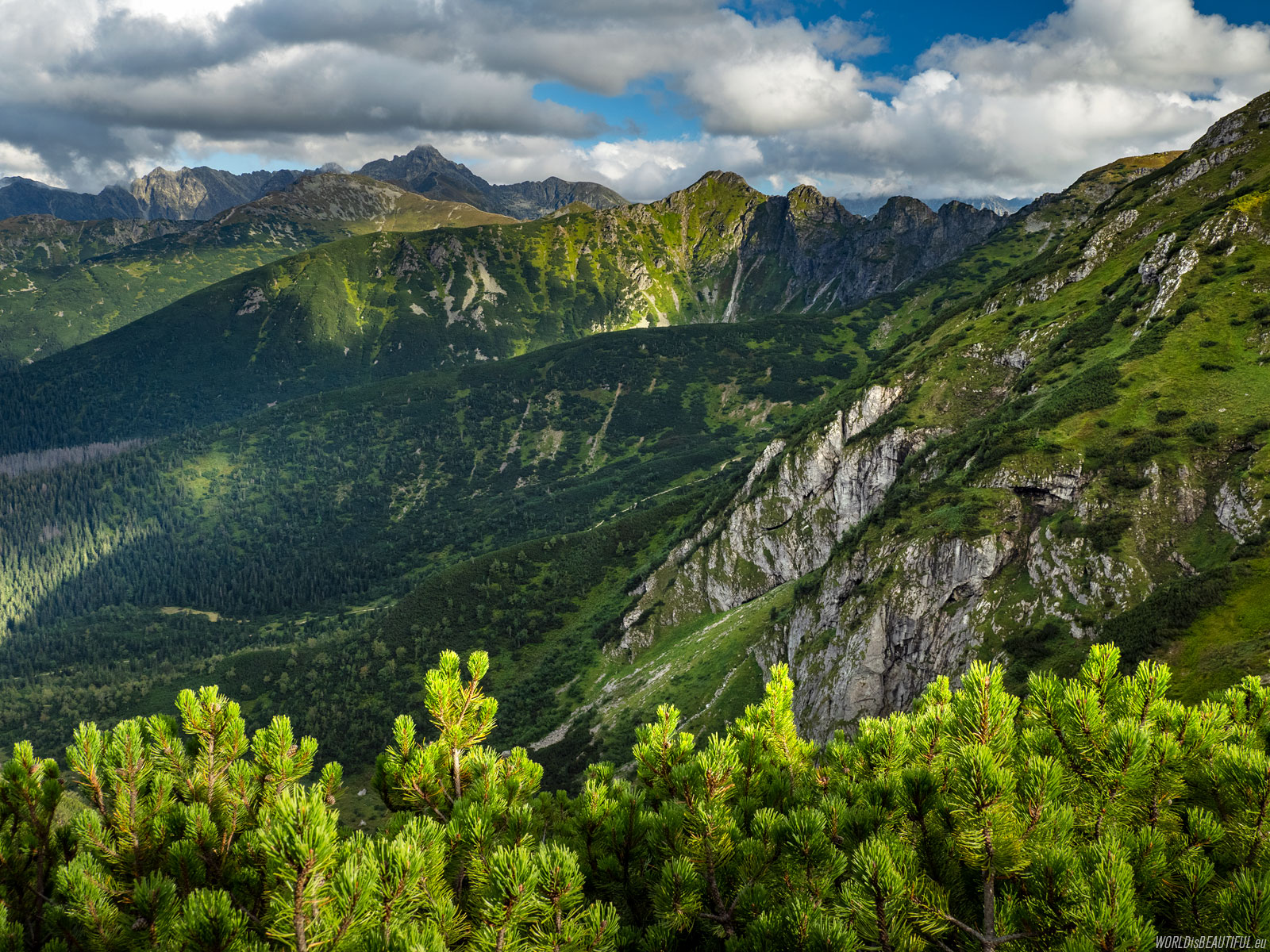
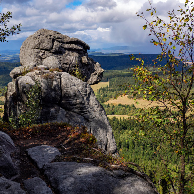
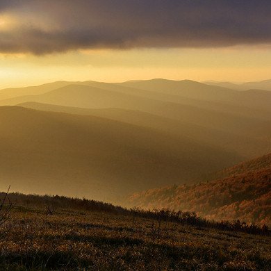
A view to the east from the slopes of Giewont to the Kondratowa Valley, Goryczkowa Czuba, Kasprowy Wierch and Świnica.
Picture number (ID): 1961 Google Map
We descended from Giewont along the blue trail through the Kondracka Pass, Kondratowa Valley to Kuźnice. According to the map, the descent time is about two and a half hours, total descents: 895 m, distance: 6 kilometers.
Picture number (ID): 1960 Google Map
Somewhere out there is a cable car
Somewhere there should be visible the cable car from Kasprowy Wiech ...
Picture number (ID): 1959
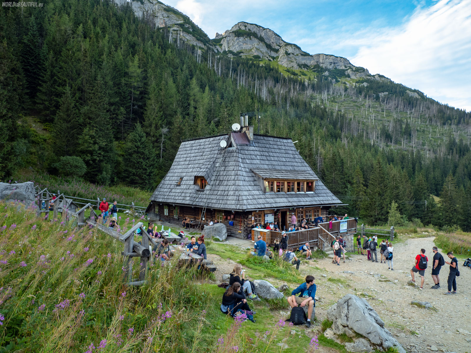
Mountain hut at Hala Kondratowa
On the blue trail on Hala Kondratowa there is a PTTK mountain hut. You can rest for a while, drink and eat something good... It's only about an hour's walk to Kuźnice from here and it's downhill almost all the time :-) so there's no rush anymore.
Picture number (ID): 1958 Google Map
Find an apartment
See other galleries: