Photo Gallery » Szpiglasowy Wierch
A trip to Szpiglasowy Wierch (2172 m above sea level) from Dolina Pięciu Stawów is not a difficult trail in summer. There are chains on the way to Szpiglasowa Przełęcz, but when it is dry this trail should not be problematic. It is about 4 kilometers from the shelter in the Dolina Pięciu Stawów Valley to the summit, which should not take more than 2.5 hours; the difference in elevation is about 500 m. I invite you to a short photo story from our trekking.


The blue trail through the valley
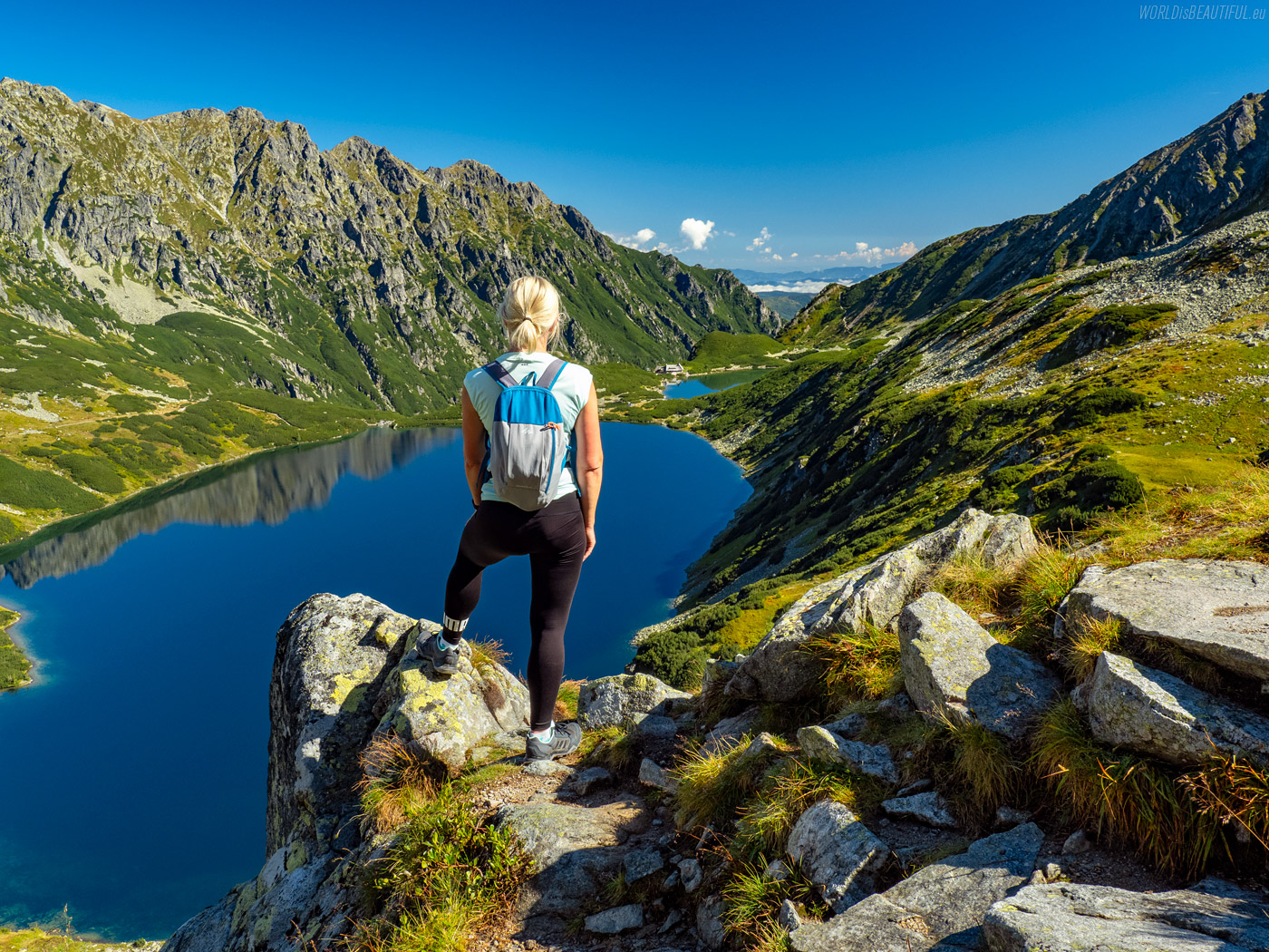
We started the blue trail from the mountain hut through the Dolina Pięciu Stawów Valley. It is probably one of the most beautiful Tatra valleys!
Picture number (ID): 1832 Google Map
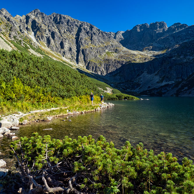
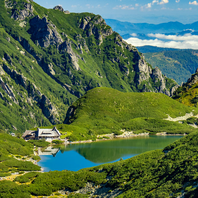
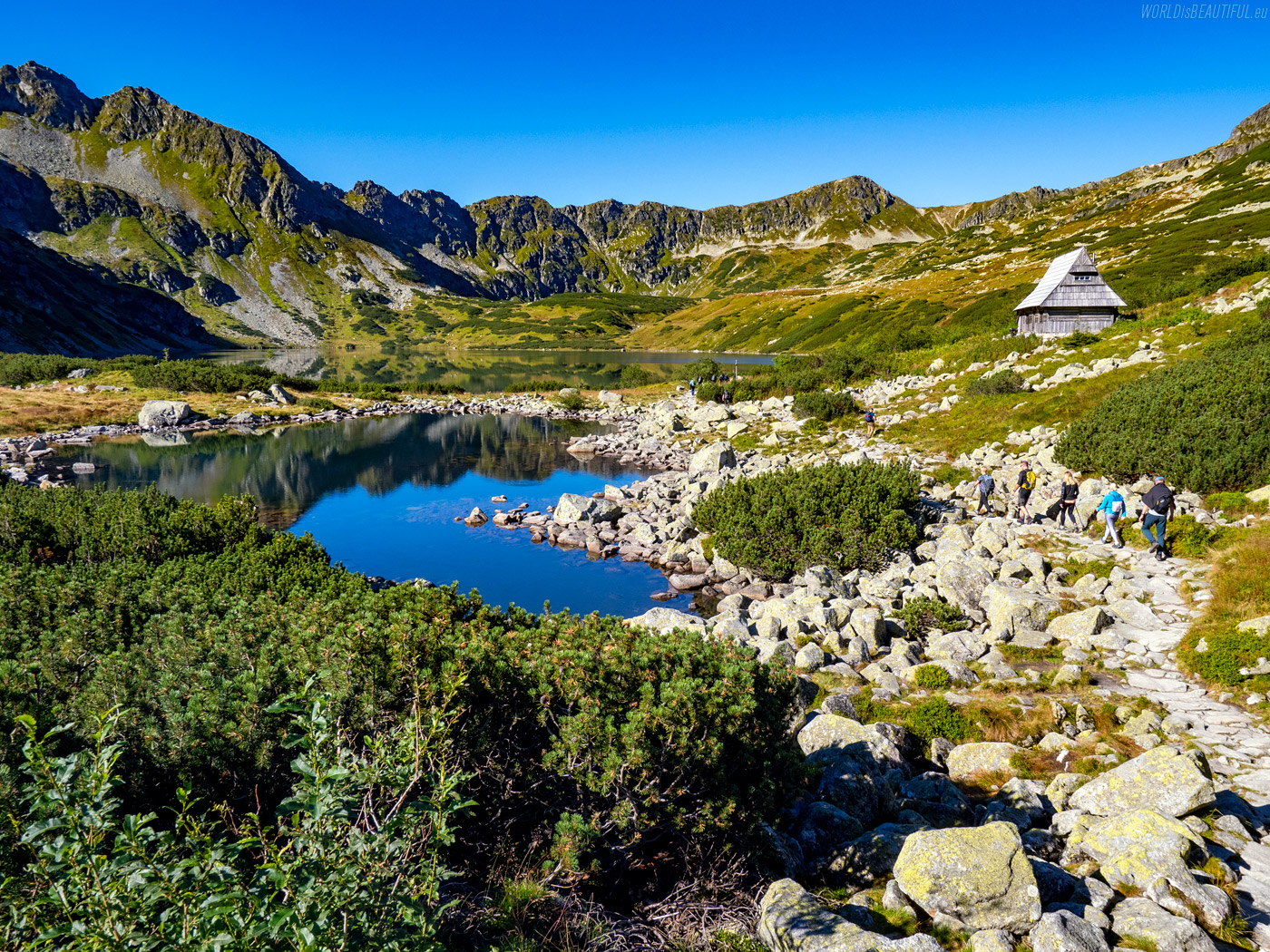
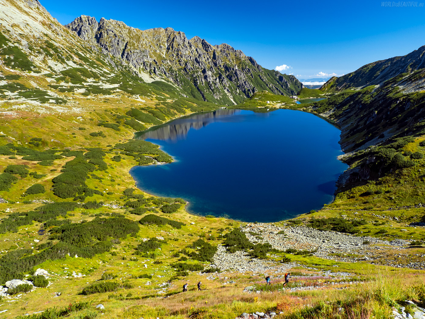
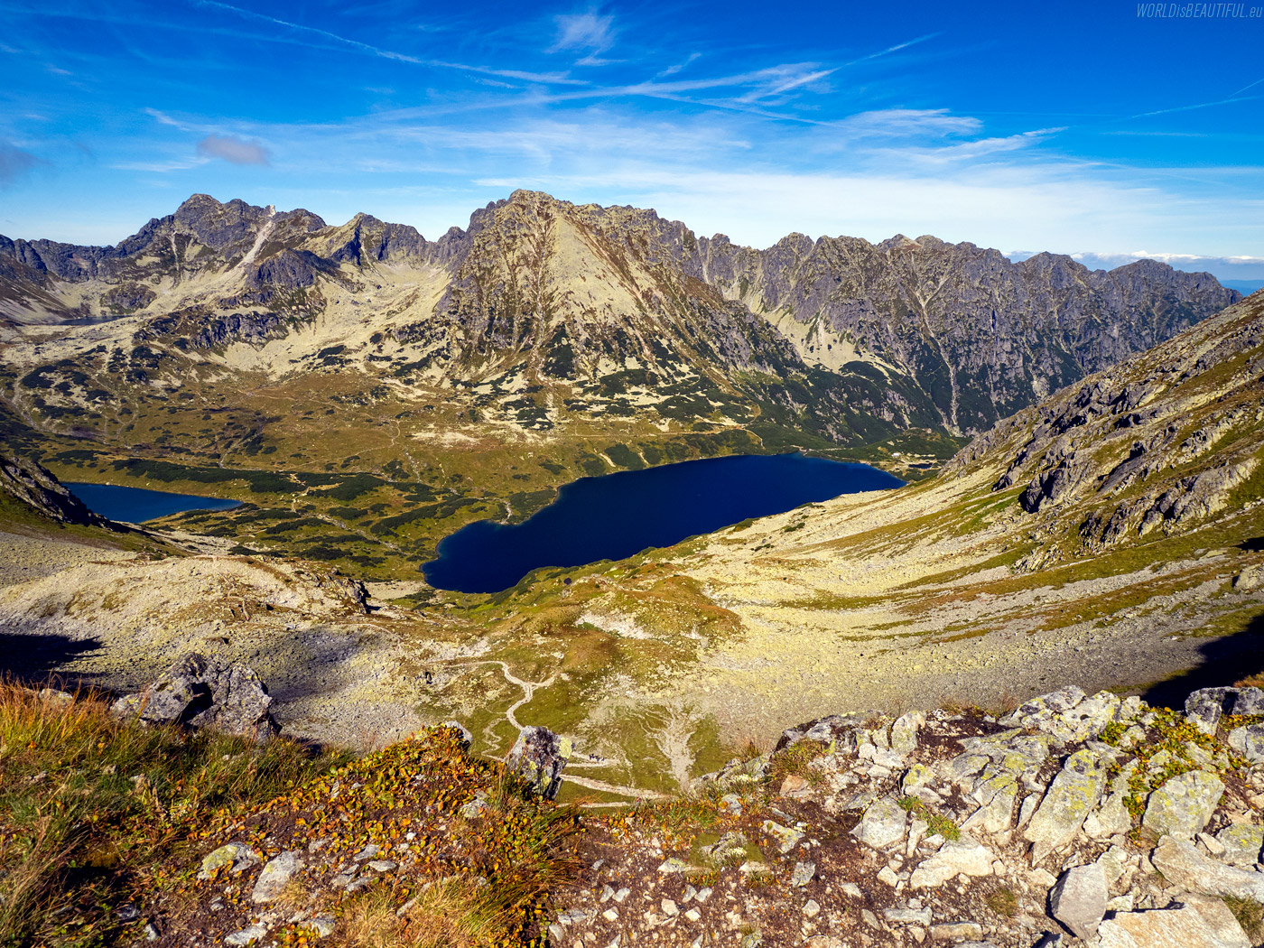
The deepest lake in the Tatras
We passed the Wielki Staw Polski on the way to Szpiglasowy Wierch. It is the deepest lake in the Tatra Mountains and the third deepest lake in Poland. According to various sources, the pond is 79.3 or 80.3 meters deep.
Picture number (ID): 1831 Google Map
We turned left onto the yellow trail behind Wielki Staw and started walking towards Szpiglasowa Przełęcz. On the way, we found a rock that reminds me a bit of the famous Norwegian Troll tongue - Trolltunga :-)
Picture number (ID): 1830 Google Map
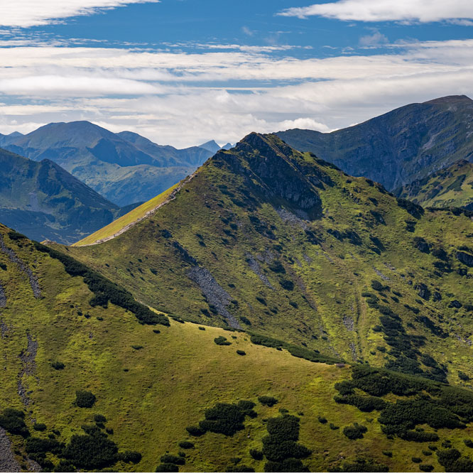
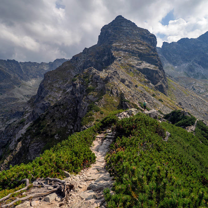
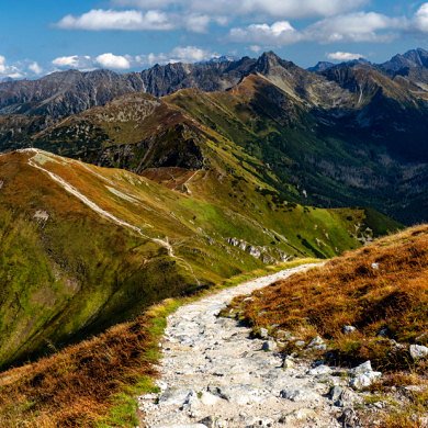
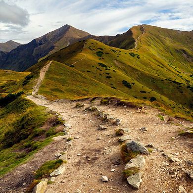
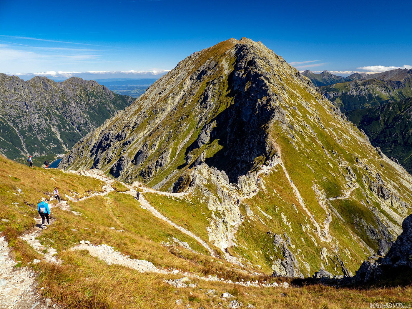
Hiking trial to Szpiglasowy Peak
The yellow mountain trail to Szpiglasowy Wierch rises with gentle curves towards the pass. We go up and admire the changing mountain landscapes.
Picture number (ID): 1829 Google Map
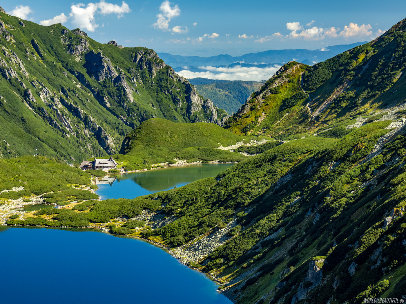
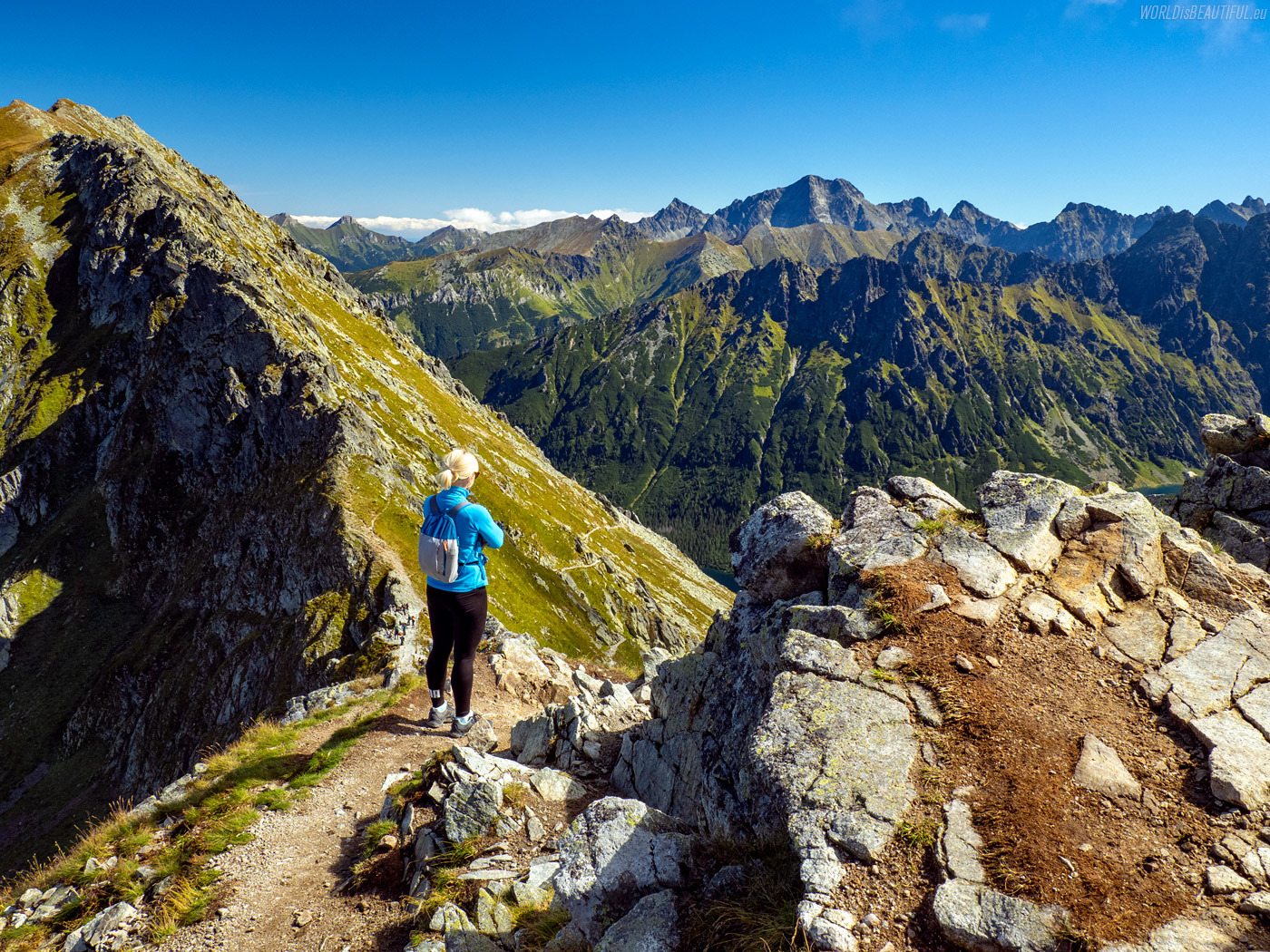
There, you can enjoy views of the Valley of the Five Lakes and beautifully situated mountain hut along the way.
Picture number (ID): 1828 Google Map
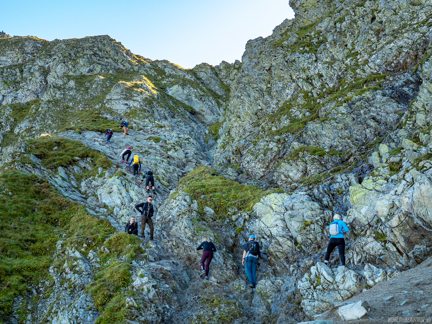
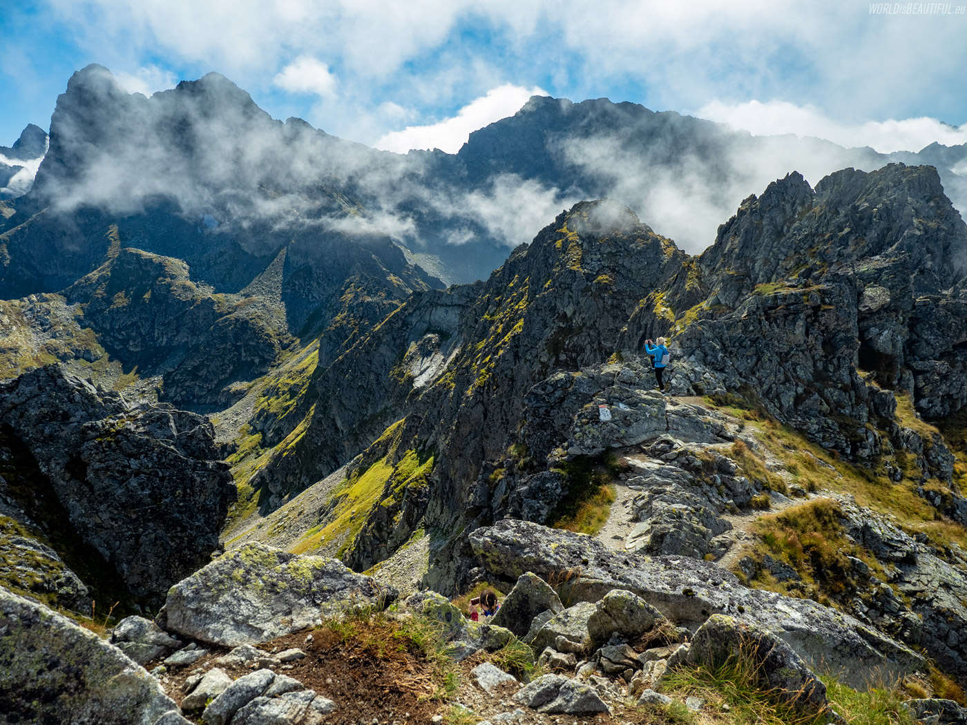
Chains on the hiking trail to Szpiglasowy Wierch
There is a short section of the trail with chains just before the Szpiglasowa Przełęcz.
Picture number (ID): 1827 Google Map
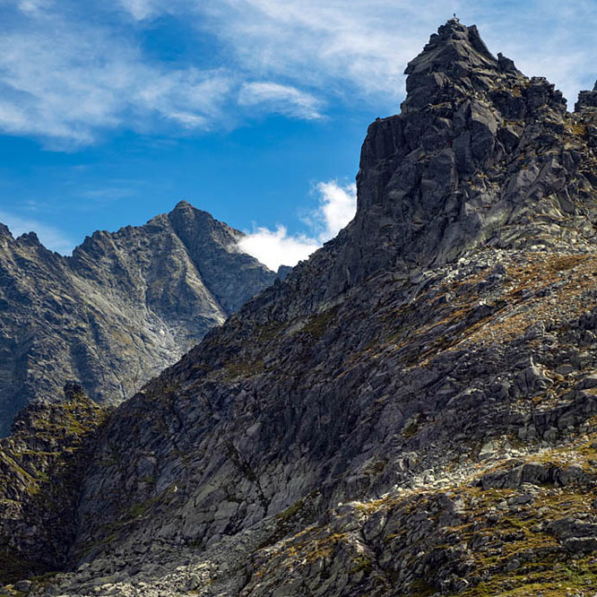
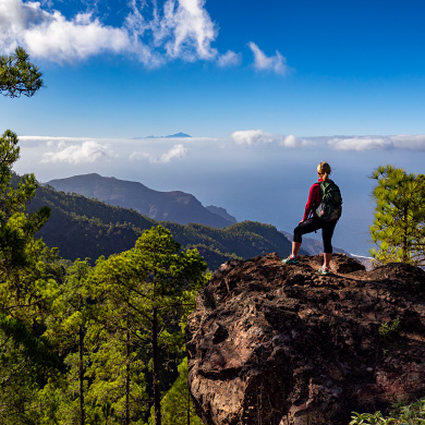
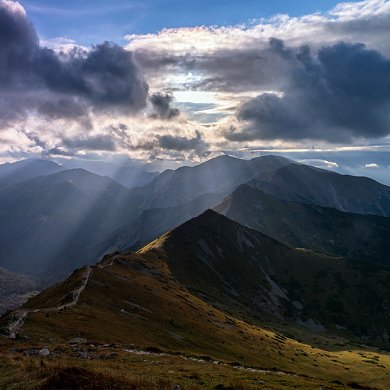
There is no universal answer to this question ... There is time in the mountains to take a distance from everyday life and focus on the present - to be 100% "here and now".
This allows you to experience and admire nature more deeply and to overcome your weaknesses and fears. If you manage to calm down and achieve inner peace, a walk among the wonders of nature can be a form of deep meditation, and if not, such views from the peaks will reward every effort.
The photo shows Cubryna, Mięguszowieckie Szczyty and Koprowa Wierch.
Picture number (ID): 1826 Google Map
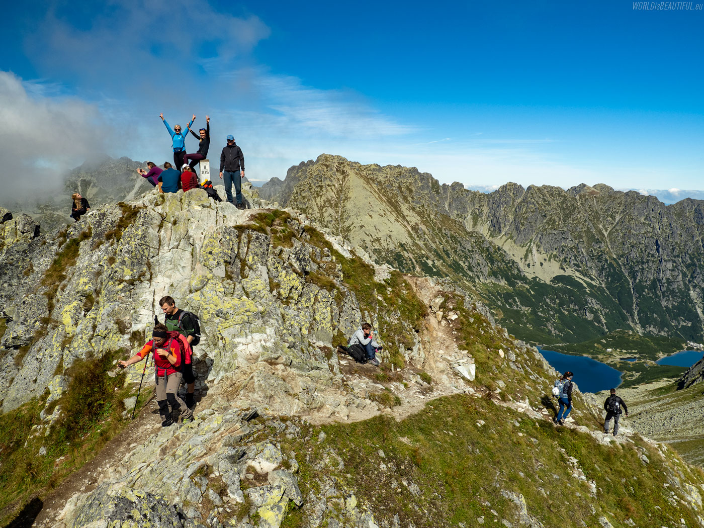
The peak Szpiglasowy Wierch 2172 m
We reached the top of Szpiglasowy Wierch just over two hours after leaving the hut :-) There is joy!
Picture number (ID): 1825 Google Map
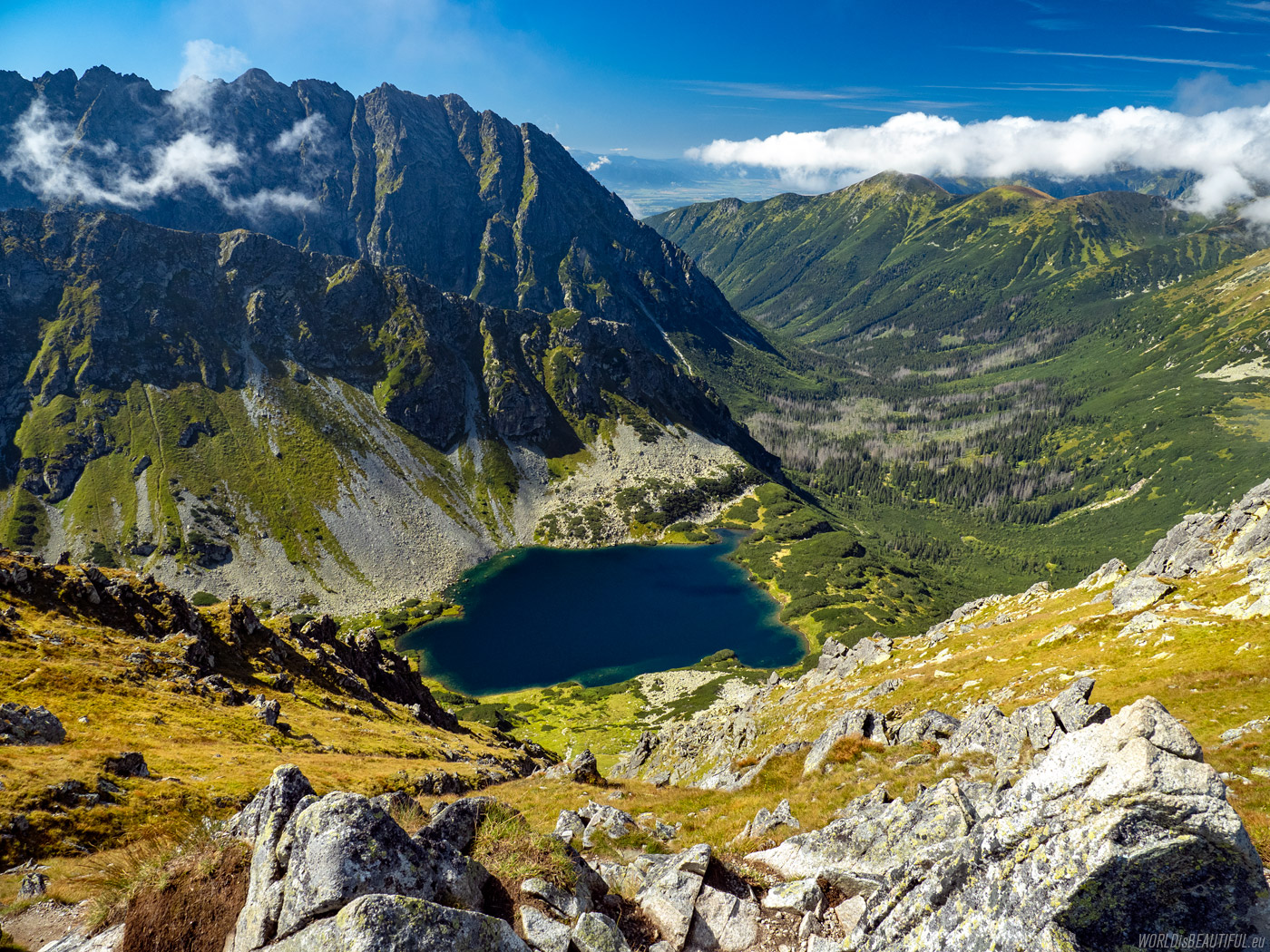
A view from the top of "Szpiglas" to the Slovakian Tatra Mountains: Kôprová dolina, Nižné Temnosmrečinské pleso and the slopes of Kôprovský štít and Hrubá kopa.
Picture number (ID): 1824 Google Map
View from the top of Szpiglasowy Wierch
Panorama of the High Tatras from the top of Szpiglasowy Wierch.
Picture number (ID): 1823 Google Map
View of the whole Orla Perć (from Świnica, through Zawrat, Kozi Wierch, Granaty to the Krzyżne pass) and the Dolina Pięciu Stawów (Valley of Five Ponds) from Szpiglasowa Przełęcz.
Picture number (ID): 1822 Google Map
We went from the top to Szpiglasowa Przełęcz (2110 m above sea level). We followed the yellow hiking trail from the pass towards Morskie Oko to the Dolina za Mnichem to enter Wrota Chałubińskiego.
Picture number (ID): 1821 Google Map
Find an apartment
See other galleries: